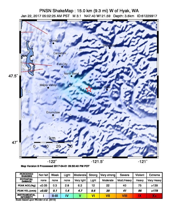
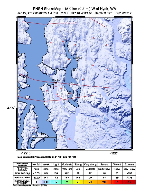
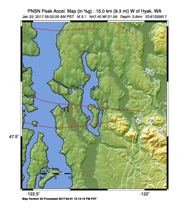
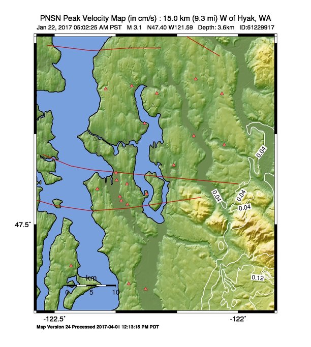
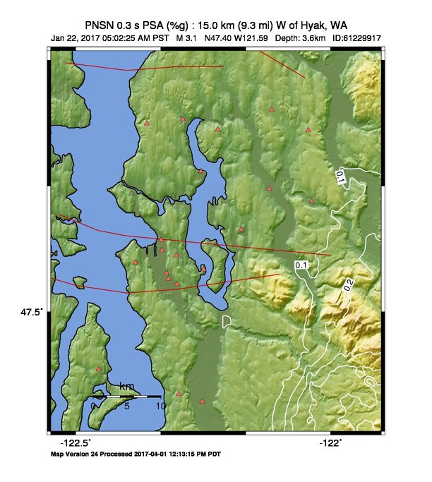
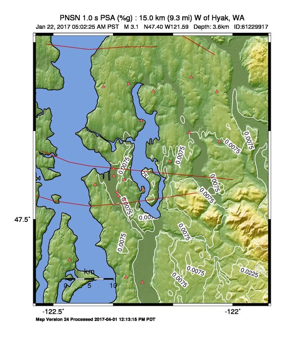
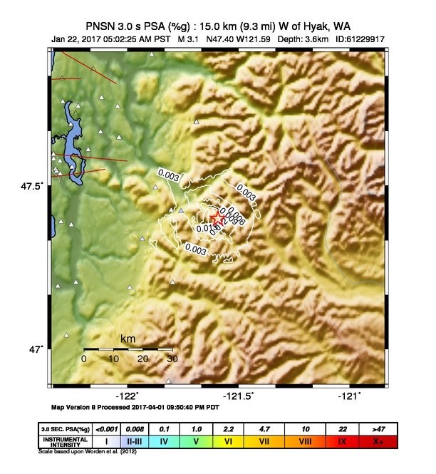
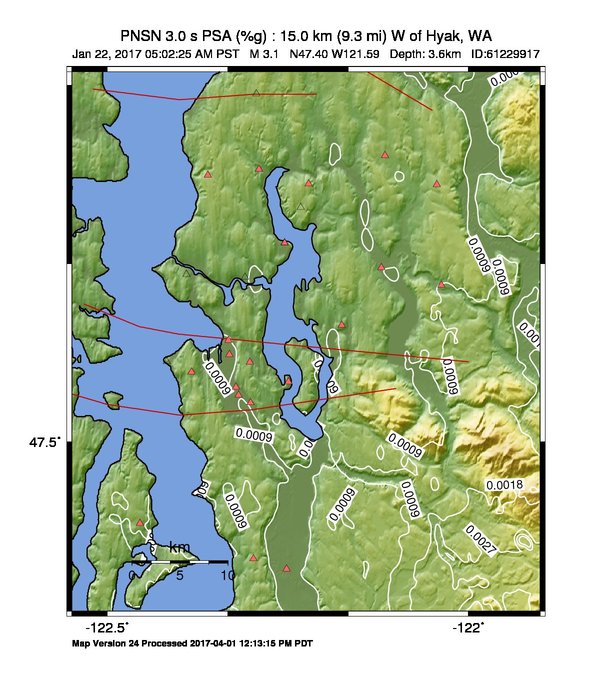
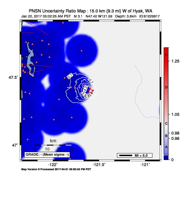
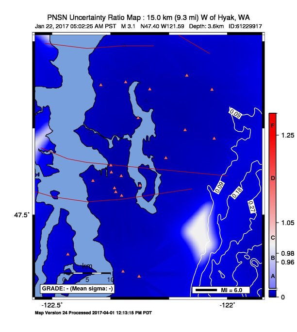
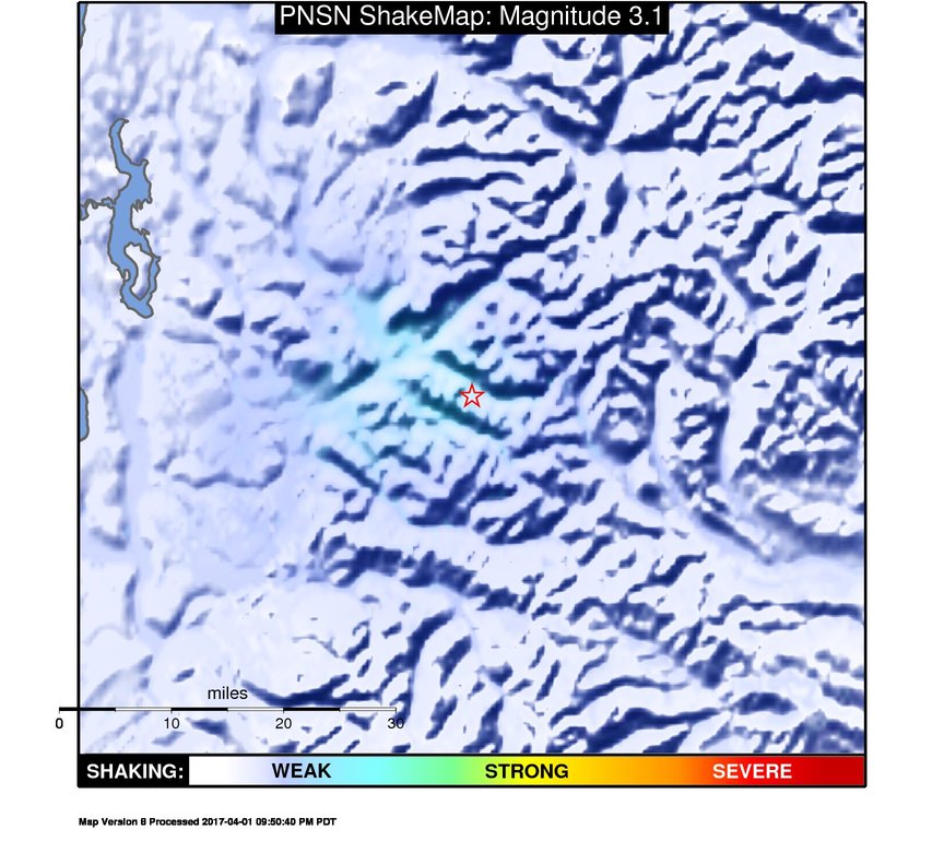
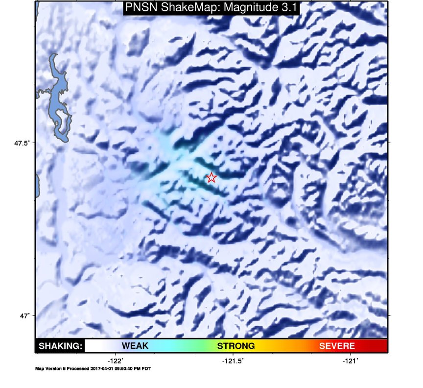
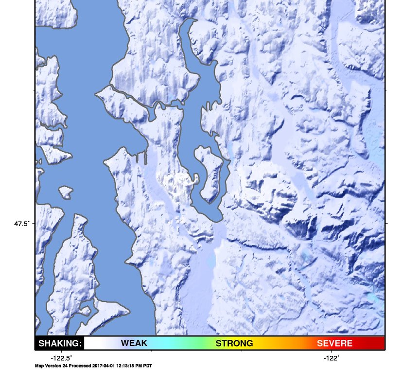
ShakeMap
Time:
Sun January 22, 2017 13:02:25 (UTC)
|
Depth:
3.64 km
|
Event ID:
61229917
|
Location:
47.4, -121.592


Downloads
| Regional | High Resolution Seattle | |
|---|---|---|
| intensity | JPG | PS.ZIP | JPG | PS.ZIP |
| acceleration | JPG | PS.ZIP | JPG | PS.ZIP |
| velocity | JPG | PS.ZIP | JPG | PS.ZIP |
| spectral 0.3 | JPG | PS.ZIP | JPG | PS.ZIP |
| spectral 1.0 | JPG | PS.ZIP | JPG | PS.ZIP |
| spectral 3.0 | JPG | PS.ZIP | JPG | PS.ZIP |
| uncertainty | JPG | PS.ZIP | JPG | PS.ZIP |
| tv map | JPG | PS.ZIP | JPG | PS.ZIP |
| tv map bare | JPG | PS.ZIP | JPG | PS.ZIP |
| tv info sheet | TXT | TXT |
| grid | XYZ.ZIP | XML.ZIP | XYZ.ZIP | XML.ZIP |
| gis | ZIP | ZIP |
| station | TXT | XML | TXT | XML |
| metadata | TXT | TXT |
Earthquake
| Event ID | Magnitude | Date | Time | Lat | Lon | Depth |
| 61229917 | 3.1 | // | :: | N47.39950 | W121.59200 | 3.64 km |
| Magnitude Bias: | MMI | PGA | PGV | PSA 0.3 | PSA 1.0 | PSA 3.0 |
| -0.84 | 0.20 | 0.24 | 0.31 | 0.35 | 0.41 |
Seismic Stations
| CC.OBSR: | Observation Rock, Mt. Rainier, WA | Agency: Cascade Chain Volcano Monitoring | |||
| Lat: 46.89972 Lon: -121.81533 Distance: 58.20 km from source | |||||
| Intensity: 1.0 | |||||
| Station Comp | Max Vel (cm/s) | Max Acc (%g) | PSA: 0.3 sec (%g) | 1.0 sec (%g) | 3.0 sec (%g) |
| --.BHE | 0.0064 | 0.0220 | 0.0354 | 0.0023 | 0.0002 |
| --.BHN | 0.0077 | 0.0309 | 0.0372 | 0.0027 | 0.0002 |
| UW.ALCT: | Alcott School, Redmond ANSS-SMO | Agency: Pacific Northwest Regional Seismic Network | |||
| Lat: 47.64690 Lon: -122.03770 Distance: 43.47 km from source | |||||
| Intensity: 1.8 | |||||
| Station Comp | Max Vel (cm/s) | Max Acc (%g) | PSA: 0.3 sec (%g) | 1.0 sec (%g) | 3.0 sec (%g) |
| --.ENN | 0.0262 | 0.0872 | 0.1153 | 0.0082 | 0.0009 |
| --.ENE | 0.0337 | 0.0850 | 0.1140 | 0.0070 | 0.0007 |
| UW.BRKS: | Brookside ANSS-SMO | Agency: Pacific Northwest Regional Seismic Network | |||
| Lat: 47.75520 Lon: -122.29013 Distance: 65.73 km from source | |||||
| Intensity: 1.0 | |||||
| Station Comp | Max Vel (cm/s) | Max Acc (%g) | PSA: 0.3 sec (%g) | 1.0 sec (%g) | 3.0 sec (%g) |
| --.ENN | 0.0074 | 0.0253 | 0.0283 | 0.0031 | 0.0004 |
| --.ENE | 0.0059 | 0.0128 | 0.0218 | 0.0025 | 0.0002 |
| UW.CDMR: | Cedar Moraine SMO | Agency: Pacific Northwest Regional Seismic Network | |||
| Lat: 47.42226 Lon: -121.75779 Distance: 13.24 km from source | |||||
| Intensity: 3.5 | |||||
| Station Comp | Max Vel (cm/s) | Max Acc (%g) | PSA: 0.3 sec (%g) | 1.0 sec (%g) | 3.0 sec (%g) |
| --.ENN | 0.3585 | 2.4026 | 0.7823 | 0.0634 | 0.0071 |
| --.ENE | 0.1289 | 1.0114 | 0.4528 | 0.0469 | 0.0020 |
| UW.EARN: | East Ridge ES ANSS-SMO | Agency: Pacific Northwest Regional Seismic Network | |||
| Lat: 47.74090 Lon: -122.04380 Distance: 51.02 km from source | |||||
| Intensity: 1.1 | |||||
| Station Comp | Max Vel (cm/s) | Max Acc (%g) | PSA: 0.3 sec (%g) | 1.0 sec (%g) | 3.0 sec (%g) |
| --.ENN | 0.0045 | 0.0158 | 0.0198 | 0.0024 | 0.0003 |
| --.ENE | 0.0159 | 0.0723 | 0.0513 | 0.0036 | 0.0005 |
| UW.ELW: | EchoLakeBPA | Agency: Pacific Northwest Regional Seismic Network | |||
| Lat: 47.49410 Lon: -121.87267 Distance: 23.86 km from source | |||||
| Intensity: 2.7 | |||||
| Station Comp | Max Vel (cm/s) | Max Acc (%g) | PSA: 0.3 sec (%g) | 1.0 sec (%g) | 3.0 sec (%g) |
| --.ENN | 0.1041 | 0.4875 | 0.4412 | 0.0206 | 0.0025 |
| --.ENE | 0.0546 | 0.3135 | 0.1844 | 0.0081 | 0.0009 |
| UW.EVGW: | Everett Gateway Middle School ANSS-SMO | Agency: Pacific Northwest Regional Seismic Network | |||
| Lat: 47.85440 Lon: -122.15338 Distance: 65.89 km from source | |||||
| Intensity: NaN | |||||
| Station Comp | Max Vel (cm/s) | Max Acc (%g) | PSA: 0.3 sec (%g) | 1.0 sec (%g) | 3.0 sec (%g) |
| --.ENN | 0.0026 -G | 0.0089 -G | 0.0171 -G | 0.0015 -G | 0.0003 -G |
| --.ENE | 0.0037 -G | 0.0084 -G | 0.0136 -G | 0.0014 -G | 0.0003 -G |
| UW.FINN: | Finn Hill Jr High ANSS-SMO | Agency: Pacific Northwest Regional Seismic Network | |||
| Lat: 47.71950 Lon: -122.23220 Distance: 59.89 km from source | |||||
| Intensity: NaN | |||||
| Station Comp | Max Vel (cm/s) | Max Acc (%g) | PSA: 0.3 sec (%g) | 1.0 sec (%g) | 3.0 sec (%g) |
| --.ENN | 0.0058 | 0.0115 | 0.0272 | 0.0016 | 0.0006 |
| --.ENE | 0.0084 -G | 0.0082 -G | 0.0148 -G | 0.0016 -G | 0.0007 -G |
| UW.GHW: | Garrison Hill | Agency: Pacific Northwest Regional Seismic Network | |||
| Lat: 47.04149 Lon: -122.27373 Distance: 65.18 km from source | |||||
| Intensity: 1.0 | |||||
| Station Comp | Max Vel (cm/s) | Max Acc (%g) | PSA: 0.3 sec (%g) | 1.0 sec (%g) | 3.0 sec (%g) |
| --.ENN | 0.0077 | 0.0399 | 0.0327 | 0.0018 | 0.0003 |
| --.ENE | 0.0113 | 0.0570 | 0.0352 | 0.0020 | 0.0003 |
| UW.GSM: | Grass Mt. | Agency: Pacific Northwest Regional Seismic Network | |||
| Lat: 47.20388 Lon: -121.79604 Distance: 26.89 km from source | |||||
| Intensity: 2.3 | |||||
| Station Comp | Max Vel (cm/s) | Max Acc (%g) | PSA: 0.3 sec (%g) | 1.0 sec (%g) | 3.0 sec (%g) |
| --.ENN | 0.0578 | 0.2318 | 0.1564 | 0.0083 | 0.0008 |
| --.ENE | 0.0367 | 0.1248 | 0.2098 | 0.0075 | 0.0007 |
| UW.GTWN: | Georgetown Playfield ANSS-SMO | Agency: Pacific Northwest Regional Seismic Network | |||
| Lat: 47.55121 Lon: -122.32201 Distance: 57.52 km from source | |||||
| Intensity: 1.0 | |||||
| Station Comp | Max Vel (cm/s) | Max Acc (%g) | PSA: 0.3 sec (%g) | 1.0 sec (%g) | 3.0 sec (%g) |
| --.ENN | 0.0051 | 0.0117 | 0.0279 | 0.0077 | 0.0004 |
| --.ENE | 0.0055 | 0.0113 | 0.0306 | 0.0038 | 0.0003 |
| UW.HICC: | Highline CC ANSS-SMO | Agency: Pacific Northwest Regional Seismic Network | |||
| Lat: 47.39012 Lon: -122.29790 Distance: 53.27 km from source | |||||
| Intensity: 1.0 | |||||
| Station Comp | Max Vel (cm/s) | Max Acc (%g) | PSA: 0.3 sec (%g) | 1.0 sec (%g) | 3.0 sec (%g) |
| --.ENN | 0.0048 | 0.0188 | 0.0183 | 0.0031 | 0.0008 |
| --.ENE | 0.0058 | 0.0130 | 0.0173 | 0.0034 | 0.0006 |
| UW.KCAM: | King County Airport Maint. Shop, ANSS-SMO | Agency: Pacific Northwest Regional Seismic Network | |||
| Lat: 47.54400 Lon: -122.31850 Distance: 57.04 km from source | |||||
| Intensity: 1.0 | |||||
| Station Comp | Max Vel (cm/s) | Max Acc (%g) | PSA: 0.3 sec (%g) | 1.0 sec (%g) | 3.0 sec (%g) |
| --.ENN | 0.0044 | 0.0127 | 0.0221 | 0.0063 | 0.0006 |
| --.ENE | 0.0047 | 0.0122 | 0.0127 | 0.0051 | 0.0004 |
| UW.KDK: | Coastal Environmental, Seattle ANSS-SMO | Agency: Pacific Northwest Regional Seismic Network | |||
| Lat: 47.59520 Lon: -122.33223 Distance: 59.83 km from source | |||||
| Intensity: 1.0 | |||||
| Station Comp | Max Vel (cm/s) | Max Acc (%g) | PSA: 0.3 sec (%g) | 1.0 sec (%g) | 3.0 sec (%g) |
| --.ENN | 0.0118 | 0.0179 | 0.0515 | 0.0121 | 0.0011 |
| --.ENE | 0.0083 | 0.0106 | 0.0351 | 0.0049 | 0.0007 |
| UW.KIMB: | Kimball School ANSS-SMO | Agency: Pacific Northwest Regional Seismic Network | |||
| Lat: 47.57480 Lon: -122.30280 Distance: 56.97 km from source | |||||
| Intensity: 1.0 | |||||
| Station Comp | Max Vel (cm/s) | Max Acc (%g) | PSA: 0.3 sec (%g) | 1.0 sec (%g) | 3.0 sec (%g) |
| --.ENN | 0.0088 | 0.0109 | 0.0143 | 0.0067 | 0.0011 |
| --.ENE | 0.0046 | 0.0145 | 0.0197 | 0.0032 | 0.0008 |
| UW.KNEL: | Kent Elementary ANSS-SMO | Agency: Pacific Northwest Regional Seismic Network | |||
| Lat: 47.38052 Lon: -122.25193 Distance: 49.86 km from source | |||||
| Intensity: 1.0 | |||||
| Station Comp | Max Vel (cm/s) | Max Acc (%g) | PSA: 0.3 sec (%g) | 1.0 sec (%g) | 3.0 sec (%g) |
| --.ENN | 0.0146 | 0.0328 | 0.0949 | 0.0120 | 0.0008 |
| --.ENE | 0.0142 | 0.0411 | 0.0732 | 0.0088 | 0.0006 |
| UW.LEOT: | Leota J. High ANSS-SMO | Agency: Pacific Northwest Regional Seismic Network | |||
| Lat: 47.76790 Lon: -122.11560 Distance: 56.86 km from source | |||||
| Intensity: 1.0 | |||||
| Station Comp | Max Vel (cm/s) | Max Acc (%g) | PSA: 0.3 sec (%g) | 1.0 sec (%g) | 3.0 sec (%g) |
| --.ENN | 0.0097 | 0.0139 | 0.0304 | 0.0024 | 0.0007 |
| --.ENE | 0.0079 | 0.0158 | 0.0261 | 0.0026 | 0.0008 |
| UW.LYNC: | Lynnwood City Hall, ANSS-SMO | Agency: Pacific Northwest Regional Seismic Network | |||
| Lat: 47.82555 Lon: -122.29384 Distance: 70.89 km from source | |||||
| Intensity: NaN | |||||
| Station Comp | Max Vel (cm/s) | Max Acc (%g) | PSA: 0.3 sec (%g) | 1.0 sec (%g) | 3.0 sec (%g) |
| --.ENN | 0.0017 -G | 0.0043 -G | 0.0065 -G | 0.0007 -G | 0.0002 -G |
| --.ENE | 0.0031 -G | 0.0038 -G | 0.0063 -G | 0.0011 -G | 0.0003 -G |
| UW.MARY: | Marymoor Park ANSS-SMO | Agency: Pacific Northwest Regional Seismic Network | |||
| Lat: 47.66334 Lon: -122.12068 Distance: 49.49 km from source | |||||
| Intensity: 1.0 | |||||
| Station Comp | Max Vel (cm/s) | Max Acc (%g) | PSA: 0.3 sec (%g) | 1.0 sec (%g) | 3.0 sec (%g) |
| --.ENN | 0.0080 | 0.0214 | 0.0416 | 0.0065 | 0.0005 |
| --.ENE | 0.0081 | 0.0236 | 0.0367 | 0.0081 | 0.0007 |
| UW.MBPA: | Monroe BPA, WA, USA | Agency: Pacific Northwest Regional Seismic Network | |||
| Lat: 47.89835 Lon: -121.89018 Distance: 59.91 km from source | |||||
| Intensity: 1.0 | |||||
| Station Comp | Max Vel (cm/s) | Max Acc (%g) | PSA: 0.3 sec (%g) | 1.0 sec (%g) | 3.0 sec (%g) |
| --.ENN | 0.0072 | 0.0312 | 0.0230 | 0.0009 | 0.0004 |
| --.ENE | 0.0083 | 0.0269 | 0.0331 | 0.0015 | 0.0006 |
| UW.MPL: | Maple Valley SMO | Agency: Pacific Northwest Regional Seismic Network | |||
| Lat: 47.68630 Lon: -122.25444 Distance: 59.18 km from source | |||||
| Intensity: 1.0 | |||||
| Station Comp | Max Vel (cm/s) | Max Acc (%g) | PSA: 0.3 sec (%g) | 1.0 sec (%g) | 3.0 sec (%g) |
| --.ENN | 0.0062 | 0.0143 | 0.0290 | 0.0034 | 0.0006 |
| --.ENE | 0.0127 | 0.0130 | 0.0310 | 0.0027 | 0.0008 |
| UW.NIHS: | Inglemoor HS ANSS-SMO | Agency: Pacific Northwest Regional Seismic Network | |||
| Lat: 47.74144 Lon: -122.22141 Distance: 60.73 km from source | |||||
| Intensity: 1.0 | |||||
| Station Comp | Max Vel (cm/s) | Max Acc (%g) | PSA: 0.3 sec (%g) | 1.0 sec (%g) | 3.0 sec (%g) |
| --.ENN | 0.0068 | 0.0190 | 0.0229 | 0.0024 | 0.0008 |
| --.ENE | 0.0067 | 0.0135 | 0.0155 | 0.0033 | 0.0007 |
| UW.NOWS: | NOAA, Seattle Bldg 3-SMO-IDS20 | Agency: Pacific Northwest Regional Seismic Network | |||
| Lat: 47.68630 Lon: -122.25444 Distance: 59.18 km from source | |||||
| Intensity: 1.0 | |||||
| Station Comp | Max Vel (cm/s) | Max Acc (%g) | PSA: 0.3 sec (%g) | 1.0 sec (%g) | 3.0 sec (%g) |
| --.ENN | 0.0078 | 0.0198 | 0.0326 | 0.0033 | 0.0005 |
| --.ENE | 0.0048 | 0.0155 | 0.0216 | 0.0034 | 0.0005 |
| UW.PAYL: | Puyallup School ANSS-SMO | Agency: Pacific Northwest Regional Seismic Network | |||
| Lat: 47.19278 Lon: -122.31278 Distance: 59.13 km from source | |||||
| Intensity: 1.0 | |||||
| Station Comp | Max Vel (cm/s) | Max Acc (%g) | PSA: 0.3 sec (%g) | 1.0 sec (%g) | 3.0 sec (%g) |
| --.ENN | 0.0146 | 0.0472 | 0.0601 | 0.0072 | 0.0015 |
| --.ENE | 0.0131 | 0.0334 | 0.0463 | 0.0046 | 0.0009 |
| UW.RATT: | Rattlesnake Lake, WA | Agency: Pacific Northwest Seismic NetworkNetwork | |||
| Lat: 47.42546 Lon: -121.80254 Distance: 16.51 km from source | |||||
| Intensity: 2.6 | |||||
| Station Comp | Max Vel (cm/s) | Max Acc (%g) | PSA: 0.3 sec (%g) | 1.0 sec (%g) | 3.0 sec (%g) |
| --.BHE | 0.1005 | 0.6170 | 0.1814 | 0.0109 | 0.0012 |
| --.BHN | 0.0889 | 0.5222 | 0.2969 | 0.0173 | 0.0014 |
| UW.RAW: | Raver BPA SMO-IDS20 | Agency: Pacific Northwest Regional Seismic Network | |||
| Lat: 47.33705 Lon: -121.93267 Distance: 26.83 km from source | |||||
| Intensity: 3.1 | |||||
| Station Comp | Max Vel (cm/s) | Max Acc (%g) | PSA: 0.3 sec (%g) | 1.0 sec (%g) | 3.0 sec (%g) |
| --.ENN | 0.1125 | 0.4045 | 0.5133 | 0.0243 | 0.0025 |
| --.ENE | 0.2069 | 0.5469 | 0.7916 | 0.0361 | 0.0034 |
| UW.SEA: | Seattle (Wood Anderson SMO) | Agency: Pacific Northwest Regional Seismic Network | |||
| Lat: 47.65421 Lon: -122.30938 Distance: 60.96 km from source | |||||
| Intensity: NaN | |||||
| Station Comp | Max Vel (cm/s) | Max Acc (%g) | PSA: 0.3 sec (%g) | 1.0 sec (%g) | 3.0 sec (%g) |
| --.ENN | 0.0006 -G | 0.0018 -G | 0.0005 -G | 0.0002 -G | 0.0001 -G |
| --.ENE | 0.0030 | 0.0217 | 0.0123 | 0.0018 | 0.0004 |
| UW.SMNR: | Sumner HS ANSS-SMO | Agency: Pacific Northwest Regional Seismic Network | |||
| Lat: 47.20460 Lon: -122.23150 Distance: 52.99 km from source | |||||
| Intensity: 1.4 | |||||
| Station Comp | Max Vel (cm/s) | Max Acc (%g) | PSA: 0.3 sec (%g) | 1.0 sec (%g) | 3.0 sec (%g) |
| --.ENN | 0.0189 | 0.0236 | 0.0844 | 0.0099 | 0.0013 |
| --.ENE | 0.0233 | 0.0307 | 0.1435 | 0.0133 | 0.0014 |
| UW.SP2: | Seward Park, Seattle SMO-IDS24 BB(7/97) | Agency: Pacific Northwest Regional Seismic Network | |||
| Lat: 47.55629 Lon: -122.24923 Distance: 52.51 km from source | |||||
| Intensity: 1.0 | |||||
| Station Comp | Max Vel (cm/s) | Max Acc (%g) | PSA: 0.3 sec (%g) | 1.0 sec (%g) | 3.0 sec (%g) |
| --.BHE | 0.0003 | 0.0007 | 0.0013 | 0.0001 | 0.0000 |
| --.BHN | 0.0154 | 0.0411 | 0.0586 | 0.0056 | 0.0005 |
| UW.SSS2: | John Stanford Center surface, Seattle, ANSS-SMO | Agency: Pacific Northwest Regional Seismic Network | |||
| Lat: 47.58180 Lon: -122.33109 Distance: 59.23 km from source | |||||
| Intensity: 1.1 | |||||
| Station Comp | Max Vel (cm/s) | Max Acc (%g) | PSA: 0.3 sec (%g) | 1.0 sec (%g) | 3.0 sec (%g) |
| --.ENN | 0.0166 | 0.0352 | 0.0882 | 0.0253 | 0.0012 |
| --.ENE | 0.0132 | 0.0163 | 0.0628 | 0.0128 | 0.0011 |
| UW.STOR: | Enumclaw, WA, USA | Agency: Pacific Northwest Regional Seismic Network | |||
| Lat: 47.18810 Lon: -121.98880 Distance: 38.23 km from source | |||||
| Intensity: 1.2 | |||||
| Station Comp | Max Vel (cm/s) | Max Acc (%g) | PSA: 0.3 sec (%g) | 1.0 sec (%g) | 3.0 sec (%g) |
| --.HHE | 0.0094 | 0.0404 | 0.0553 | 0.0036 | 0.0004 |
| --.HHN | 0.0190 | 0.0532 | 0.0760 | 0.0064 | 0.0006 |
| UW.TKCO: | King Co EOC - SMO | Agency: Pacific Northwest Regional Seismic Network | |||
| Lat: 47.53668 Lon: -122.30165 Distance: 55.60 km from source | |||||
| Intensity: 1.0 | |||||
| Station Comp | Max Vel (cm/s) | Max Acc (%g) | PSA: 0.3 sec (%g) | 1.0 sec (%g) | 3.0 sec (%g) |
| --.ENN | 0.0099 | 0.0271 | 0.0526 | 0.0030 | 0.0003 |
| --.ENE | 0.0125 | 0.0289 | 0.0634 | 0.0043 | 0.0005 |
| UW.TLW1: | Tolt Reservoir, Control House, WA | Agency: Pacific Northwest Regional Seismic Network | |||
| Lat: 47.69295 Lon: -121.68879 Distance: 33.63 km from source | |||||
| Intensity: 1.7 | |||||
| Station Comp | Max Vel (cm/s) | Max Acc (%g) | PSA: 0.3 sec (%g) | 1.0 sec (%g) | 3.0 sec (%g) |
| --.ENN | 0.0298 | 0.2195 | 0.1269 | 0.0048 | 0.0005 |
| --.ENE | 0.0323 | 0.2088 | 0.1921 | 0.0052 | 0.0004 |
| UW.TOLT: | Tolt Res, WA old TA-C05A | Agency: Pacific Northwest Regional Seismic Network | |||
| Lat: 47.69470 Lon: -121.68950 Distance: 33.83 km from source | |||||
| Intensity: 1.4 | |||||
| Station Comp | Max Vel (cm/s) | Max Acc (%g) | PSA: 0.3 sec (%g) | 1.0 sec (%g) | 3.0 sec (%g) |
| --.BHE | 0.0240 | 0.1050 | 0.0559 | 0.0042 | 0.0003 |
| --.BHN | 0.0172 | 0.1095 | 0.0523 | 0.0023 | 0.0002 |
| UW.WISC: | Wilburton Center ANSS-SMO | Agency: Pacific Northwest Regional Seismic Network | |||
| Lat: 47.60926 Lon: -122.17553 Distance: 49.78 km from source | |||||
| Intensity: 1.0 | |||||
| Station Comp | Max Vel (cm/s) | Max Acc (%g) | PSA: 0.3 sec (%g) | 1.0 sec (%g) | 3.0 sec (%g) |
| --.ENN | 0.0073 | 0.0230 | 0.0330 | 0.0084 | 0.0006 |
| --.ENE | 0.0060 | 0.0234 | 0.0222 | 0.0045 | 0.0006 |
Earthquake
| Event ID | Magnitude | Date | Time | Lat | Lon | Depth |
| 61229917 | 3.1 | // | :: | N47.39950 | W121.59200 | 3.64 km |
| Magnitude Bias: | MMI | PGA | PGV | PSA 0.3 | PSA 1.0 | PSA 3.0 |
| -0.75 | 0.30 | 0.35 | 0.36 | 0.36 | 0.45 |
Seismic Stations
| UW.ALCT: | Alcott School, Redmond ANSS-SMO | Agency: Pacific Northwest Regional Seismic Network | |||
| Lat: 47.64690 Lon: -122.03770 Distance: 43.47 km from epicenter | |||||
| Intensity: 1.8 | |||||
| Station Comp | Max Vel (cm/s) | Max Acc (%g) | PSA: 0.3 sec (%g) | 1.0 sec (%g) | 3.0 sec (%g) |
| --.ENN | 0.0262 | 0.0872 | 0.1153 | 0.0082 | 0.0009 |
| --.ENE | 0.0337 | 0.0850 | 0.1140 | 0.0070 | 0.0007 |
| UW.ALKI: | Alki Wastewater Plant ANSS-SMO | Agency: Pacific Northwest Regional Seismic Network | |||
| Lat: 47.57510 Lon: -122.41760 Distance: 65.14 km from epicenter | |||||
| Intensity: NaN | |||||
| Station Comp | Max Vel (cm/s) | Max Acc (%g) | PSA: 0.3 sec (%g) | 1.0 sec (%g) | 3.0 sec (%g) |
| --.ENN | 0.0058 -G | 0.0040 -G | 0.0064 -G | 0.0018 -G | 0.0006 -G |
| --.ENE | 0.0061 -G | 0.0032 -G | 0.0070 -G | 0.0018 -G | 0.0007 -G |
| UW.BRKS: | Brookside ANSS-SMO | Agency: Pacific Northwest Regional Seismic Network | |||
| Lat: 47.75520 Lon: -122.29013 Distance: 65.73 km from epicenter | |||||
| Intensity: 1.0 | |||||
| Station Comp | Max Vel (cm/s) | Max Acc (%g) | PSA: 0.3 sec (%g) | 1.0 sec (%g) | 3.0 sec (%g) |
| --.ENN | 0.0074 | 0.0253 | 0.0283 | 0.0031 | 0.0004 |
| --.ENE | 0.0059 | 0.0128 | 0.0218 | 0.0025 | 0.0002 |
| UW.EARN: | East Ridge ES ANSS-SMO | Agency: Pacific Northwest Regional Seismic Network | |||
| Lat: 47.74090 Lon: -122.04380 Distance: 51.02 km from epicenter | |||||
| Intensity: 1.1 | |||||
| Station Comp | Max Vel (cm/s) | Max Acc (%g) | PSA: 0.3 sec (%g) | 1.0 sec (%g) | 3.0 sec (%g) |
| --.ENN | 0.0045 | 0.0158 | 0.0198 | 0.0024 | 0.0003 |
| --.ENE | 0.0159 | 0.0723 | 0.0513 | 0.0036 | 0.0005 |
| UW.FINN: | Finn Hill Jr High ANSS-SMO | Agency: Pacific Northwest Regional Seismic Network | |||
| Lat: 47.71950 Lon: -122.23220 Distance: 59.89 km from epicenter | |||||
| Intensity: NaN | |||||
| Station Comp | Max Vel (cm/s) | Max Acc (%g) | PSA: 0.3 sec (%g) | 1.0 sec (%g) | 3.0 sec (%g) |
| --.ENN | 0.0058 | 0.0115 | 0.0272 | 0.0016 | 0.0006 |
| --.ENE | 0.0084 -G | 0.0082 -G | 0.0148 -G | 0.0016 -G | 0.0007 -G |
| UW.GTWN: | Georgetown Playfield ANSS-SMO | Agency: Pacific Northwest Regional Seismic Network | |||
| Lat: 47.55121 Lon: -122.32201 Distance: 57.52 km from epicenter | |||||
| Intensity: 1.0 | |||||
| Station Comp | Max Vel (cm/s) | Max Acc (%g) | PSA: 0.3 sec (%g) | 1.0 sec (%g) | 3.0 sec (%g) |
| --.ENN | 0.0051 | 0.0117 | 0.0279 | 0.0077 | 0.0004 |
| --.ENE | 0.0055 | 0.0113 | 0.0306 | 0.0038 | 0.0003 |
| UW.HICC: | Highline CC ANSS-SMO | Agency: Pacific Northwest Regional Seismic Network | |||
| Lat: 47.39012 Lon: -122.29790 Distance: 53.27 km from epicenter | |||||
| Intensity: 1.0 | |||||
| Station Comp | Max Vel (cm/s) | Max Acc (%g) | PSA: 0.3 sec (%g) | 1.0 sec (%g) | 3.0 sec (%g) |
| --.ENN | 0.0048 | 0.0188 | 0.0183 | 0.0031 | 0.0008 |
| --.ENE | 0.0058 | 0.0130 | 0.0173 | 0.0034 | 0.0006 |
| UW.HOLY: | Holy Rosary ANSS-SMO | Agency: Pacific Northwest Regional Seismic Network | |||
| Lat: 47.56540 Lon: -122.38360 Distance: 62.39 km from epicenter | |||||
| Intensity: 1.0 | |||||
| Station Comp | Max Vel (cm/s) | Max Acc (%g) | PSA: 0.3 sec (%g) | 1.0 sec (%g) | 3.0 sec (%g) |
| --.ENN | 0.0043 | 0.0107 | 0.0262 | 0.0028 | 0.0003 |
| --.ENE | 0.0038 | 0.0120 | 0.0204 | 0.0017 | 0.0004 |
| UW.KCAM: | King County Airport Maint. Shop, ANSS-SMO | Agency: Pacific Northwest Regional Seismic Network | |||
| Lat: 47.54400 Lon: -122.31850 Distance: 57.04 km from epicenter | |||||
| Intensity: 1.0 | |||||
| Station Comp | Max Vel (cm/s) | Max Acc (%g) | PSA: 0.3 sec (%g) | 1.0 sec (%g) | 3.0 sec (%g) |
| --.ENN | 0.0044 | 0.0127 | 0.0221 | 0.0063 | 0.0006 |
| --.ENE | 0.0047 | 0.0122 | 0.0127 | 0.0051 | 0.0004 |
| UW.KDK: | Coastal Environmental, Seattle ANSS-SMO | Agency: Pacific Northwest Regional Seismic Network | |||
| Lat: 47.59520 Lon: -122.33223 Distance: 59.83 km from epicenter | |||||
| Intensity: 1.0 | |||||
| Station Comp | Max Vel (cm/s) | Max Acc (%g) | PSA: 0.3 sec (%g) | 1.0 sec (%g) | 3.0 sec (%g) |
| --.ENN | 0.0118 | 0.0179 | 0.0515 | 0.0121 | 0.0011 |
| --.ENE | 0.0083 | 0.0106 | 0.0351 | 0.0049 | 0.0007 |
| UW.KIMB: | Kimball School ANSS-SMO | Agency: Pacific Northwest Regional Seismic Network | |||
| Lat: 47.57480 Lon: -122.30280 Distance: 56.97 km from epicenter | |||||
| Intensity: 1.0 | |||||
| Station Comp | Max Vel (cm/s) | Max Acc (%g) | PSA: 0.3 sec (%g) | 1.0 sec (%g) | 3.0 sec (%g) |
| --.ENN | 0.0088 | 0.0109 | 0.0143 | 0.0067 | 0.0011 |
| --.ENE | 0.0046 | 0.0145 | 0.0197 | 0.0032 | 0.0008 |
| UW.KNEL: | Kent Elementary ANSS-SMO | Agency: Pacific Northwest Regional Seismic Network | |||
| Lat: 47.38052 Lon: -122.25193 Distance: 49.86 km from epicenter | |||||
| Intensity: 1.0 | |||||
| Station Comp | Max Vel (cm/s) | Max Acc (%g) | PSA: 0.3 sec (%g) | 1.0 sec (%g) | 3.0 sec (%g) |
| --.ENN | 0.0146 | 0.0328 | 0.0949 | 0.0120 | 0.0008 |
| --.ENE | 0.0142 | 0.0411 | 0.0732 | 0.0088 | 0.0006 |
| UW.LAWT: | Lawton School ANSS-SMO | Agency: Pacific Northwest Regional Seismic Network | |||
| Lat: 47.65694 Lon: -122.39062 Distance: 66.54 km from epicenter | |||||
| Intensity: NaN | |||||
| Station Comp | Max Vel (cm/s) | Max Acc (%g) | PSA: 0.3 sec (%g) | 1.0 sec (%g) | 3.0 sec (%g) |
| --.ENN | 0.0042 | 0.0106 | 0.0275 | 0.0043 | 0.0004 |
| --.ENE | 0.0036 -G | 0.0081 -G | 0.0202 -G | 0.0015 -G | 0.0003 -G |
| UW.LEOT: | Leota J. High ANSS-SMO | Agency: Pacific Northwest Regional Seismic Network | |||
| Lat: 47.76790 Lon: -122.11560 Distance: 56.86 km from epicenter | |||||
| Intensity: 1.0 | |||||
| Station Comp | Max Vel (cm/s) | Max Acc (%g) | PSA: 0.3 sec (%g) | 1.0 sec (%g) | 3.0 sec (%g) |
| --.ENN | 0.0097 | 0.0139 | 0.0304 | 0.0024 | 0.0007 |
| --.ENE | 0.0079 | 0.0158 | 0.0261 | 0.0026 | 0.0008 |
| UW.LYNC: | Lynnwood City Hall, ANSS-SMO | Agency: Pacific Northwest Regional Seismic Network | |||
| Lat: 47.82555 Lon: -122.29384 Distance: 70.89 km from epicenter | |||||
| Intensity: NaN | |||||
| Station Comp | Max Vel (cm/s) | Max Acc (%g) | PSA: 0.3 sec (%g) | 1.0 sec (%g) | 3.0 sec (%g) |
| --.ENN | 0.0017 -G | 0.0043 -G | 0.0065 -G | 0.0007 -G | 0.0002 -G |
| --.ENE | 0.0031 -G | 0.0038 -G | 0.0063 -G | 0.0011 -G | 0.0003 -G |
| UW.MARY: | Marymoor Park ANSS-SMO | Agency: Pacific Northwest Regional Seismic Network | |||
| Lat: 47.66334 Lon: -122.12068 Distance: 49.49 km from epicenter | |||||
| Intensity: 1.0 | |||||
| Station Comp | Max Vel (cm/s) | Max Acc (%g) | PSA: 0.3 sec (%g) | 1.0 sec (%g) | 3.0 sec (%g) |
| --.ENN | 0.0080 | 0.0214 | 0.0416 | 0.0065 | 0.0005 |
| --.ENE | 0.0081 | 0.0236 | 0.0367 | 0.0081 | 0.0007 |
| UW.MPL: | Maple Valley SMO | Agency: Pacific Northwest Regional Seismic Network | |||
| Lat: 47.68630 Lon: -122.25444 Distance: 59.18 km from epicenter | |||||
| Intensity: 1.0 | |||||
| Station Comp | Max Vel (cm/s) | Max Acc (%g) | PSA: 0.3 sec (%g) | 1.0 sec (%g) | 3.0 sec (%g) |
| --.ENN | 0.0062 | 0.0143 | 0.0290 | 0.0034 | 0.0006 |
| --.ENE | 0.0127 | 0.0130 | 0.0310 | 0.0027 | 0.0008 |
| UW.NIHS: | Inglemoor HS ANSS-SMO | Agency: Pacific Northwest Regional Seismic Network | |||
| Lat: 47.74144 Lon: -122.22141 Distance: 60.73 km from epicenter | |||||
| Intensity: 1.0 | |||||
| Station Comp | Max Vel (cm/s) | Max Acc (%g) | PSA: 0.3 sec (%g) | 1.0 sec (%g) | 3.0 sec (%g) |
| --.ENN | 0.0068 | 0.0190 | 0.0229 | 0.0024 | 0.0008 |
| --.ENE | 0.0067 | 0.0135 | 0.0155 | 0.0033 | 0.0007 |
| UW.NOWS: | NOAA, Seattle Bldg 3-SMO-IDS20 | Agency: Pacific Northwest Regional Seismic Network | |||
| Lat: 47.68630 Lon: -122.25444 Distance: 59.18 km from epicenter | |||||
| Intensity: 1.0 | |||||
| Station Comp | Max Vel (cm/s) | Max Acc (%g) | PSA: 0.3 sec (%g) | 1.0 sec (%g) | 3.0 sec (%g) |
| --.ENN | 0.0078 | 0.0198 | 0.0326 | 0.0033 | 0.0005 |
| --.ENE | 0.0048 | 0.0155 | 0.0216 | 0.0034 | 0.0005 |
| UW.SCC: | Shoreline CC ANSS-SMO | Agency: Pacific Northwest Regional Seismic Network | |||
| Lat: 47.74965 Lon: -122.36105 Distance: 69.69 km from epicenter | |||||
| Intensity: 1.0 | |||||
| Station Comp | Max Vel (cm/s) | Max Acc (%g) | PSA: 0.3 sec (%g) | 1.0 sec (%g) | 3.0 sec (%g) |
| --.ENN | 0.0048 | 0.0175 | 0.0215 | 0.0019 | 0.0003 |
| --.ENE | 0.0041 | 0.0142 | 0.0213 | 0.0024 | 0.0004 |
| UW.SEA: | Seattle (Wood Anderson SMO) | Agency: Pacific Northwest Regional Seismic Network | |||
| Lat: 47.65421 Lon: -122.30938 Distance: 60.96 km from epicenter | |||||
| Intensity: NaN | |||||
| Station Comp | Max Vel (cm/s) | Max Acc (%g) | PSA: 0.3 sec (%g) | 1.0 sec (%g) | 3.0 sec (%g) |
| --.ENN | 0.0006 -G | 0.0018 -G | 0.0005 -G | 0.0002 -G | 0.0001 -G |
| --.ENE | 0.0030 | 0.0217 | 0.0123 | 0.0018 | 0.0004 |
| UW.SP2: | Seward Park, Seattle SMO-IDS24 BB(7/97) | Agency: Pacific Northwest Regional Seismic Network | |||
| Lat: 47.55629 Lon: -122.24923 Distance: 52.51 km from epicenter | |||||
| Intensity: 1.0 | |||||
| Station Comp | Max Vel (cm/s) | Max Acc (%g) | PSA: 0.3 sec (%g) | 1.0 sec (%g) | 3.0 sec (%g) |
| --.BHE | 0.0003 | 0.0007 | 0.0013 | 0.0001 | 0.0000 |
| --.BHN | 0.0154 | 0.0411 | 0.0586 | 0.0056 | 0.0005 |
| UW.SSS2: | John Stanford Center surface, Seattle, ANSS-SMO | Agency: Pacific Northwest Regional Seismic Network | |||
| Lat: 47.58180 Lon: -122.33109 Distance: 59.23 km from epicenter | |||||
| Intensity: 1.1 | |||||
| Station Comp | Max Vel (cm/s) | Max Acc (%g) | PSA: 0.3 sec (%g) | 1.0 sec (%g) | 3.0 sec (%g) |
| --.ENN | 0.0166 | 0.0352 | 0.0882 | 0.0253 | 0.0012 |
| --.ENE | 0.0132 | 0.0163 | 0.0628 | 0.0128 | 0.0011 |
| UW.TKCO: | King Co EOC - SMO | Agency: Pacific Northwest Regional Seismic Network | |||
| Lat: 47.53668 Lon: -122.30165 Distance: 55.60 km from epicenter | |||||
| Intensity: 1.0 | |||||
| Station Comp | Max Vel (cm/s) | Max Acc (%g) | PSA: 0.3 sec (%g) | 1.0 sec (%g) | 3.0 sec (%g) |
| --.ENN | 0.0099 | 0.0271 | 0.0526 | 0.0030 | 0.0003 |
| --.ENE | 0.0125 | 0.0289 | 0.0634 | 0.0043 | 0.0005 |
| UW.VVHS: | Vashon HS ANSS-SMO | Agency: Pacific Northwest Regional Seismic Network | |||
| Lat: 47.42345 Lon: -122.45488 Distance: 65.09 km from epicenter | |||||
| Intensity: 1.0 | |||||
| Station Comp | Max Vel (cm/s) | Max Acc (%g) | PSA: 0.3 sec (%g) | 1.0 sec (%g) | 3.0 sec (%g) |
| --.ENN | 0.0056 | 0.0336 | 0.0177 | 0.0027 | 0.0009 |
| --.ENE | 0.0069 | 0.0241 | 0.0297 | 0.0025 | 0.0007 |
| UW.WISC: | Wilburton Center ANSS-SMO | Agency: Pacific Northwest Regional Seismic Network | |||
| Lat: 47.60926 Lon: -122.17553 Distance: 49.78 km from epicenter | |||||
| Intensity: 1.0 | |||||
| Station Comp | Max Vel (cm/s) | Max Acc (%g) | PSA: 0.3 sec (%g) | 1.0 sec (%g) | 3.0 sec (%g) |
| --.ENN | 0.0073 | 0.0230 | 0.0330 | 0.0084 | 0.0006 |
| --.ENE | 0.0060 | 0.0234 | 0.0222 | 0.0045 | 0.0006 |