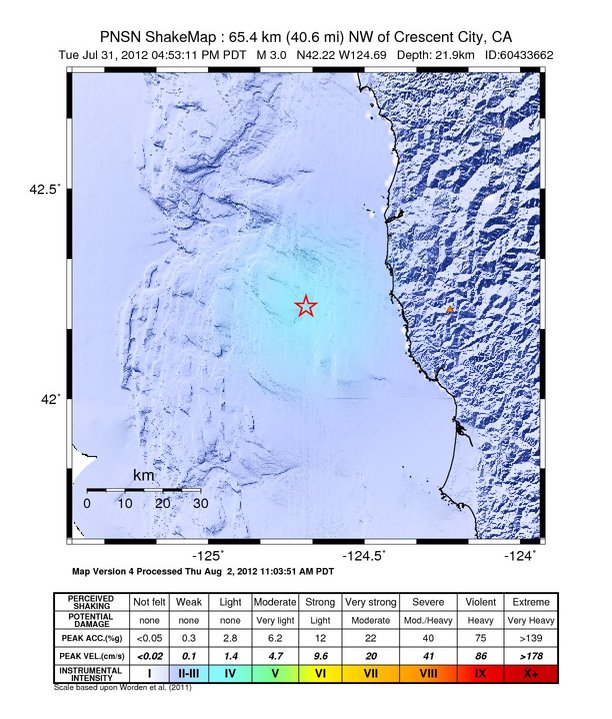
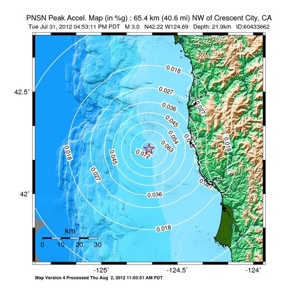
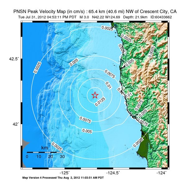
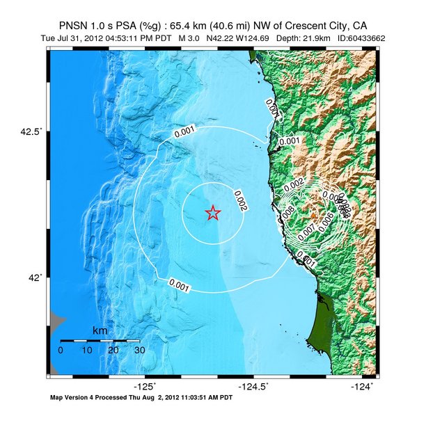
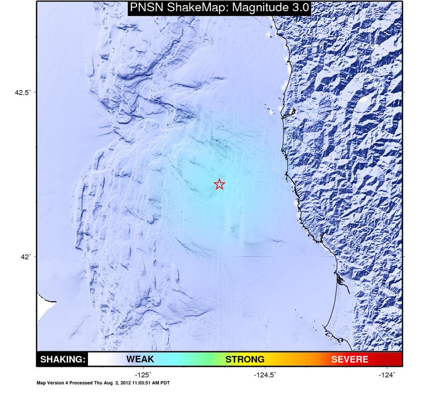
ShakeMap
Time:
Tue July 31, 2012 23:53:11 (UTC)
|
Depth:
18.88 km
|
Event ID:
60433662
|
Location:
42.219, -124.691
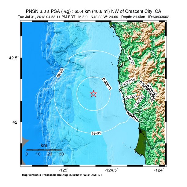
Pseudo Acceleration Spectra


Downloads
| Regional | |
|---|---|
| intensity | JPG | PS.ZIP |
| acceleration | JPG | PS.ZIP |
| velocity | JPG | PS.ZIP |
| spectral 0.3 | JPG | PS.ZIP |
| spectral 1.0 | JPG | PS.ZIP |
| spectral 3.0 | JPG | PS.ZIP |
| uncertainty | JPG | PS.ZIP |
| tv map | JPG | PS.ZIP |
| tv map bare | JPG | PS.ZIP |
| tv info sheet | TXT |
| grid | XYZ.ZIP | XML.ZIP |
| gis | ZIP |
| station | TXT | XML |
| metadata | TXT |
Earthquake
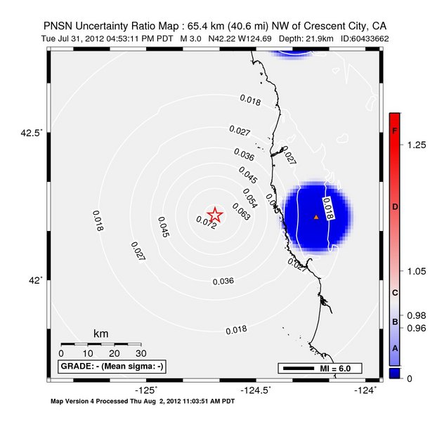
| Event ID | Magnitude | Date | Time | Lat | Lon | Depth |
| 60433662 | 3.0 | 7/31/2012 | 16:53:11 PDT | N42.2197 | W124.6872 | 21.94 km |
| Magnitude Bias: | MMI | PGA | PGV | PSA 0.3 | PSA 1.0 | PSA 3.0 |
| 0.00 | 0.00 | 0.00 | 0.00 | 0.00 | 0.00 |
Seismic Stations
| NC.KBO: | Bosley Butte | Agency: Northern California Seismic Network (NCSN) | |||
| Lat: 42.2124 Lon: -124.2260 Distance: 38.0 km from epicenter | |||||
| Intensity: 1.0 | |||||
| Station Comp | Max Vel (cm/s) | Max Acc (%g) | PSA: 0.3 sec (%g) | 1.0 sec (%g) | 3.0 sec (%g) |
| --.HHE | 0.0054 | 0.0163 | 0.0374 | 0.0051 | 0.0003 |
| --.HHN | 0.0071 | 0.0120 | 0.0370 | 0.0079 | 0.0005 |