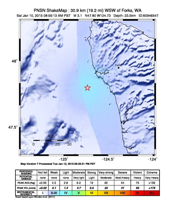
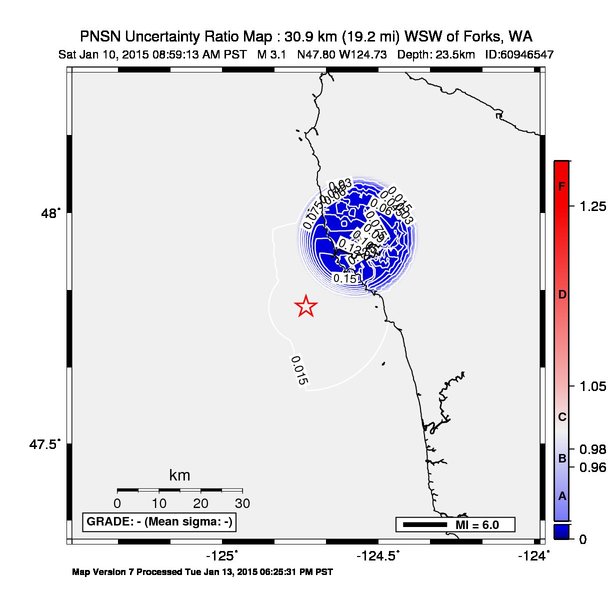
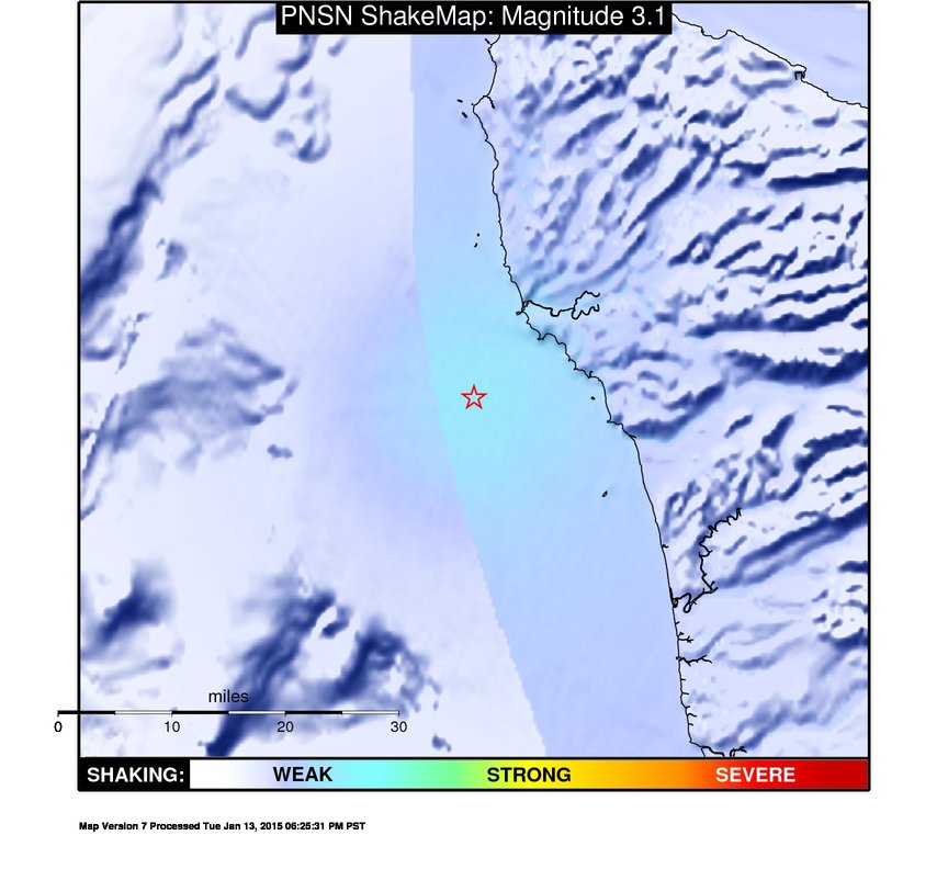
ShakeMap
Time:
Sat January 10, 2015 16:59:13 (UTC)
|
Depth:
23.06 km
|
Event ID:
60946547
|
Location:
47.797, -124.732
Pseudo Acceleration Spectra


Downloads
| Regional | |
|---|---|
| intensity | JPG | PS.ZIP |
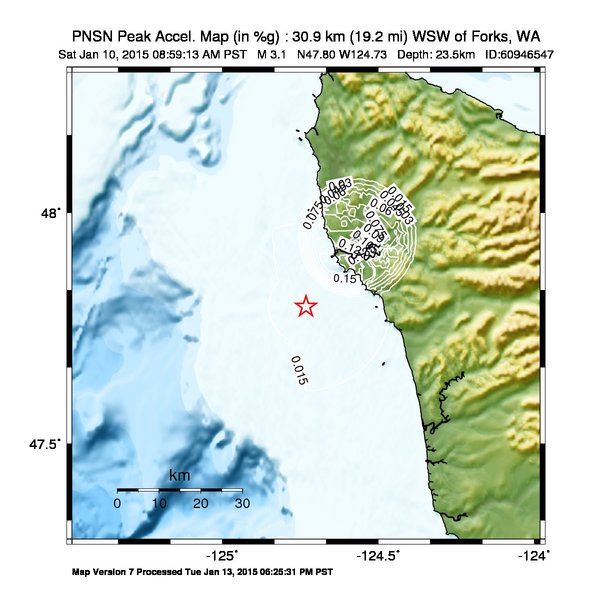
| acceleration | JPG | PS.ZIP |
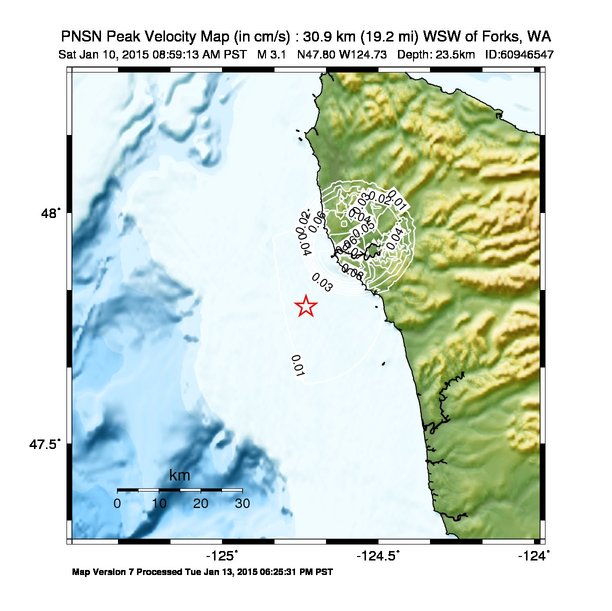
| velocity | JPG | PS.ZIP |
| spectral 0.3 | JPG | PS.ZIP |
| spectral 1.0 | JPG | PS.ZIP |
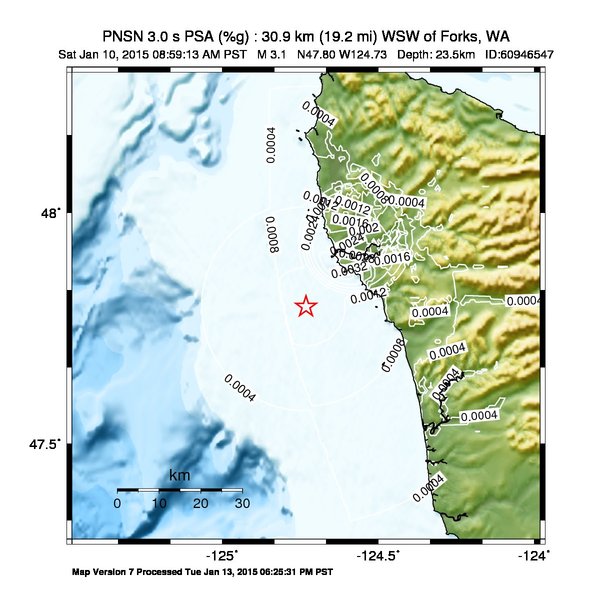
| spectral 3.0 | JPG | PS.ZIP |
| uncertainty | JPG | PS.ZIP |
| tv map | JPG | PS.ZIP |
| tv map bare | JPG | PS.ZIP |
| tv info sheet | TXT |
| grid | XYZ.ZIP | XML.ZIP |
| gis | ZIP |
| station | TXT | XML |
| metadata | TXT |
Earthquake
| Event ID | Magnitude | Date | Time | Lat | Lon | Depth |
| 60946547 | 3.1 | 1/10/2015 | 08:59:13 PST | N47.7972 | W124.7317 | 23.46 km |
| Magnitude Bias: | MMI | PGA | PGV | PSA 0.3 | PSA 1.0 | PSA 3.0 |
| -0.35 | -0.87 | -0.27 | -0.33 | 0.11 | 0.27 |
Seismic Stations
| UW.FORK: | Quillayute Airport, Forks, WA | Agency: Pacific Northwest Regional Seismic Network | |||
| Lat: 47.9475 Lon: -124.5662 Distance: 31.3 km from source | |||||
| Intensity: 2.4 | |||||
| Station Comp | Max Vel (cm/s) | Max Acc (%g) | PSA: 0.3 sec (%g) | 1.0 sec (%g) | 3.0 sec (%g) |
| --.BHE | 0.0636 | 0.1411 | 0.4362 -T | 0.0239 | 0.0017 |
| --.BHN | 0.0419 | 0.0789 | 0.3256 -T | 0.0287 | 0.0023 |