M0.9 earthquake - 12.49 mi WSW from Mt Rainier, WA
Status: Reviewed
0 Felt ReportsReport your experience
Magnitude0.9Time2014/05/07 02:05:37 AM UTCDepth3.27 miCoordinates46.7617, -121.9865ID60758517
Origin
Statistics on estimate of an earthquake's location and time. For more info, see Earthquake Terminology.Orid
1710843Magnitude
0.92Time
1399428362.5999985Latitude
46.76167Longitude
-121.98650Depth
3.27 miLocation Quality
ExcellentEvent ID
60758517Event Type
eqGtype
lHorizontal Uncertainty
0.23 miDepth Uncertainty
0.68 miAzimuthal Gap
116 degNumber of Phases
18RMS Misfit
0.11Focal Mechanisms
Describes the fault orientation and slip direction of an earthquake and are generated using first motion (up or down) observations.Solution 1
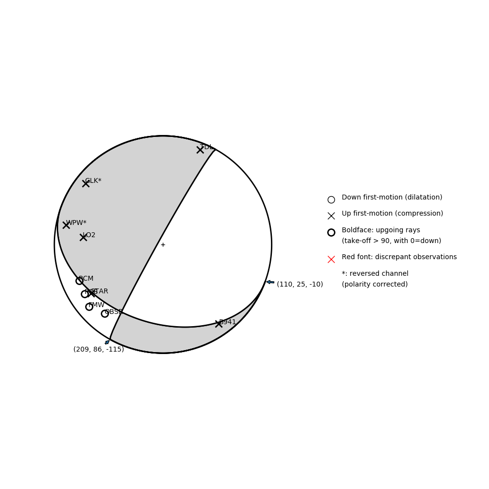
Number of P First motions: 10
| Plane A | Plane B | Uncertainty | |
|---|---|---|---|
| Strike | 110 | 209 | 15 |
| Dip | 25 | 86 | 25 |
| Rake | -10 | -115 | 40 |
Discrepant Stations
Stations whose observed first-motion does not match the predicted first-motion from the focal mechanism.| Station | Network | Channel | Polarity | Quality |
|---|---|---|---|---|
No items. | ||||
Solution 2
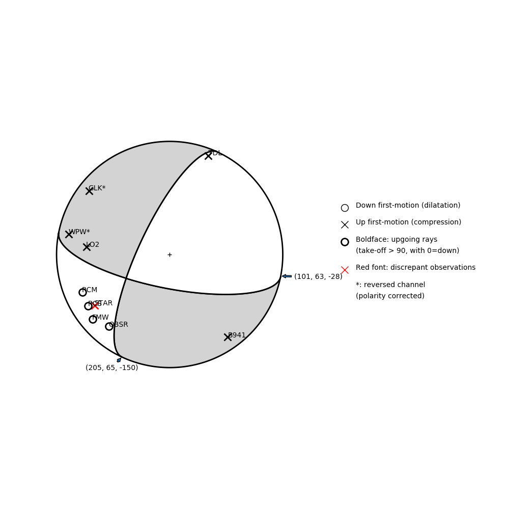
Number of P First motions: 10
| Plane A | Plane B | Uncertainty | |
|---|---|---|---|
| Strike | 205 | 101 | 25 |
| Dip | 65 | 63 | 23 |
| Rake | -150 | -28 | 25 |
Discrepant Stations
Stations whose observed first-motion does not match the predicted first-motion from the focal mechanism.| Station | Network | Channel | Polarity | Quality |
|---|---|---|---|---|
| STAR | UW | EHZ | U | 0.92 |