M1.5 earthquake - 10.75 mi WSW from Mt Rainier, WA
Status: Reviewed
0 Felt ReportsReport your experience
Magnitude1.5Time2016/07/14 05:01:30 PM UTCDepth4.67 miCoordinates46.7765, -121.9578ID61166217
Origin
Statistics on estimate of an earthquake's location and time. For more info, see Earthquake Terminology.Orid
2516053Magnitude
1.48Time
1468515716.9399986Latitude
46.77650Longitude
-121.95783Depth
4.67 miLocation Quality
ExcellentEvent ID
61166217Event Type
eqGtype
lHorizontal Uncertainty
0.29 miDepth Uncertainty
0.43 miAzimuthal Gap
93 degNumber of Phases
26RMS Misfit
0.14Focal Mechanisms
Describes the fault orientation and slip direction of an earthquake and are generated using first motion (up or down) observations.Solution 1
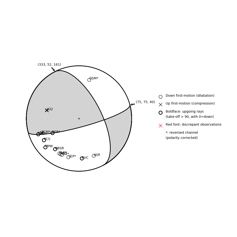
Number of P First motions: 14
| Plane A | Plane B | Uncertainty | |
|---|---|---|---|
| Strike | 75 | 333 | 13 |
| Dip | 75 | 52 | 13 |
| Rake | 40 | 161 | 40 |
Discrepant Stations
Stations whose observed first-motion does not match the predicted first-motion from the focal mechanism.| Station | Network | Channel | Polarity | Quality |
|---|---|---|---|---|
No items. | ||||
Solution 2
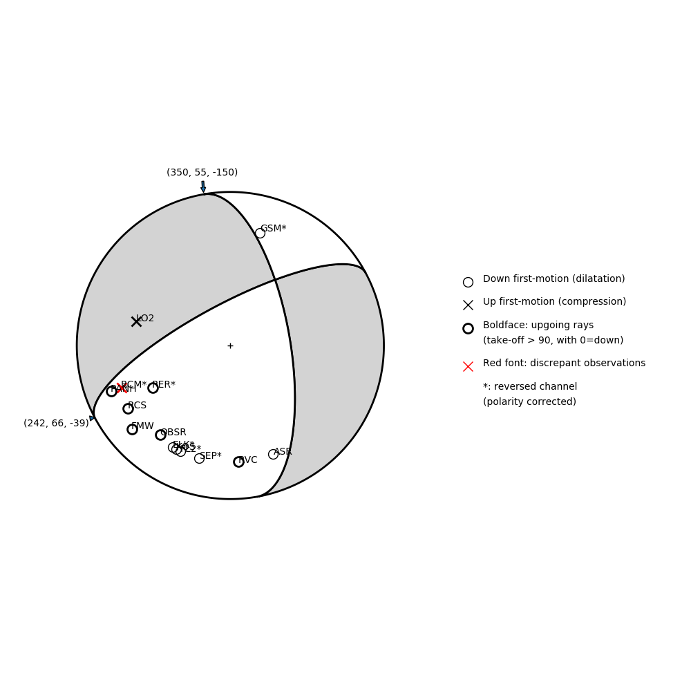
Number of P First motions: 14
| Plane A | Plane B | Uncertainty | |
|---|---|---|---|
| Strike | 350 | 242 | 13 |
| Dip | 55 | 66 | 20 |
| Rake | -150 | -39 | 20 |
Discrepant Stations
Stations whose observed first-motion does not match the predicted first-motion from the focal mechanism.| Station | Network | Channel | Polarity | Quality |
|---|---|---|---|---|
| RCM | UW | EHZ | U | 0.98 |