M0.7 earthquake - 9.45 mi WNW from Mt Rainier, WA
Status: Reviewed
0 Felt ReportsReport your experience
Magnitude0.7Time2020/02/21 10:12:41 PM UTCDepth6.06 miCoordinates46.8608, -121.9592ID61576327
Origin
Statistics on estimate of an earthquake's location and time. For more info, see Earthquake Terminology.Orid
3115893Magnitude
0.69Time
1582323188.3799973Latitude
46.86083Longitude
-121.95917Depth
6.06 miLocation Quality
ExcellentEvent ID
61576327Event Type
eqGtype
lHorizontal Uncertainty
0.3 miDepth Uncertainty
0.24 miAzimuthal Gap
188 degNumber of Phases
21RMS Misfit
0.1Focal Mechanisms
Describes the fault orientation and slip direction of an earthquake and are generated using first motion (up or down) observations.Solution 1
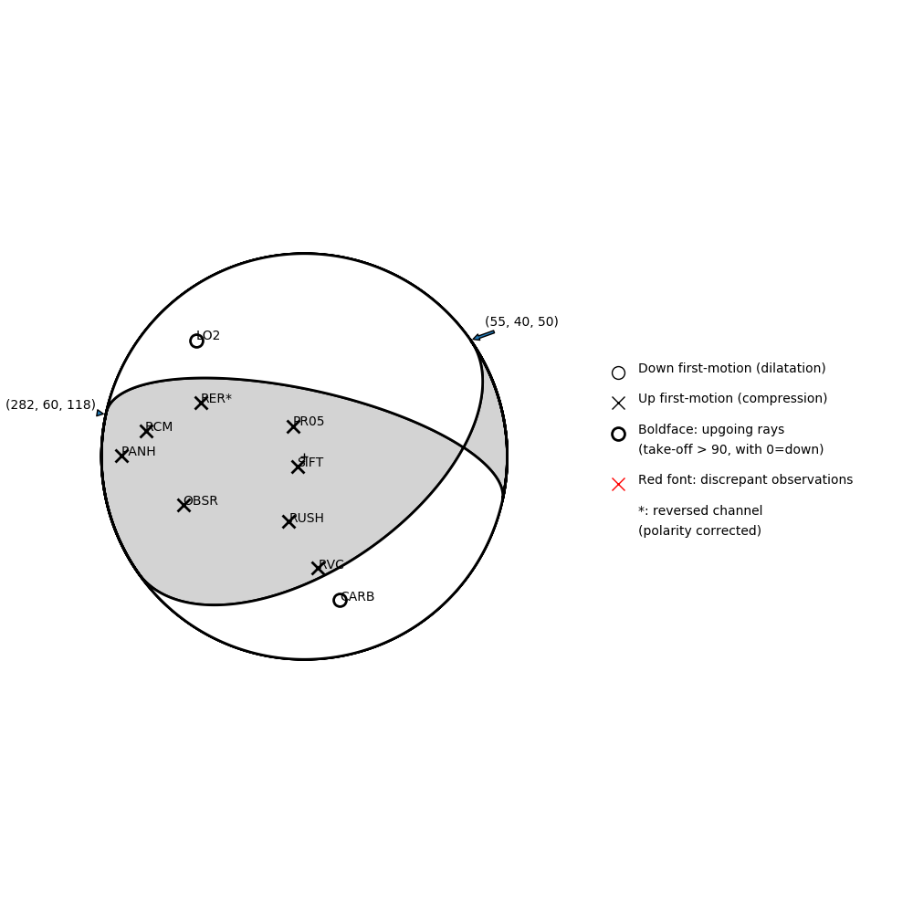
Number of P First motions: 10
| Plane A | Plane B | Uncertainty | |
|---|---|---|---|
| Strike | 55 | 282 | 30 |
| Dip | 40 | 60 | 20 |
| Rake | 50 | 118 | 25 |
Discrepant Stations
Stations whose observed first-motion does not match the predicted first-motion from the focal mechanism.| Station | Network | Channel | Polarity | Quality |
|---|---|---|---|---|
No items. | ||||
Solution 2
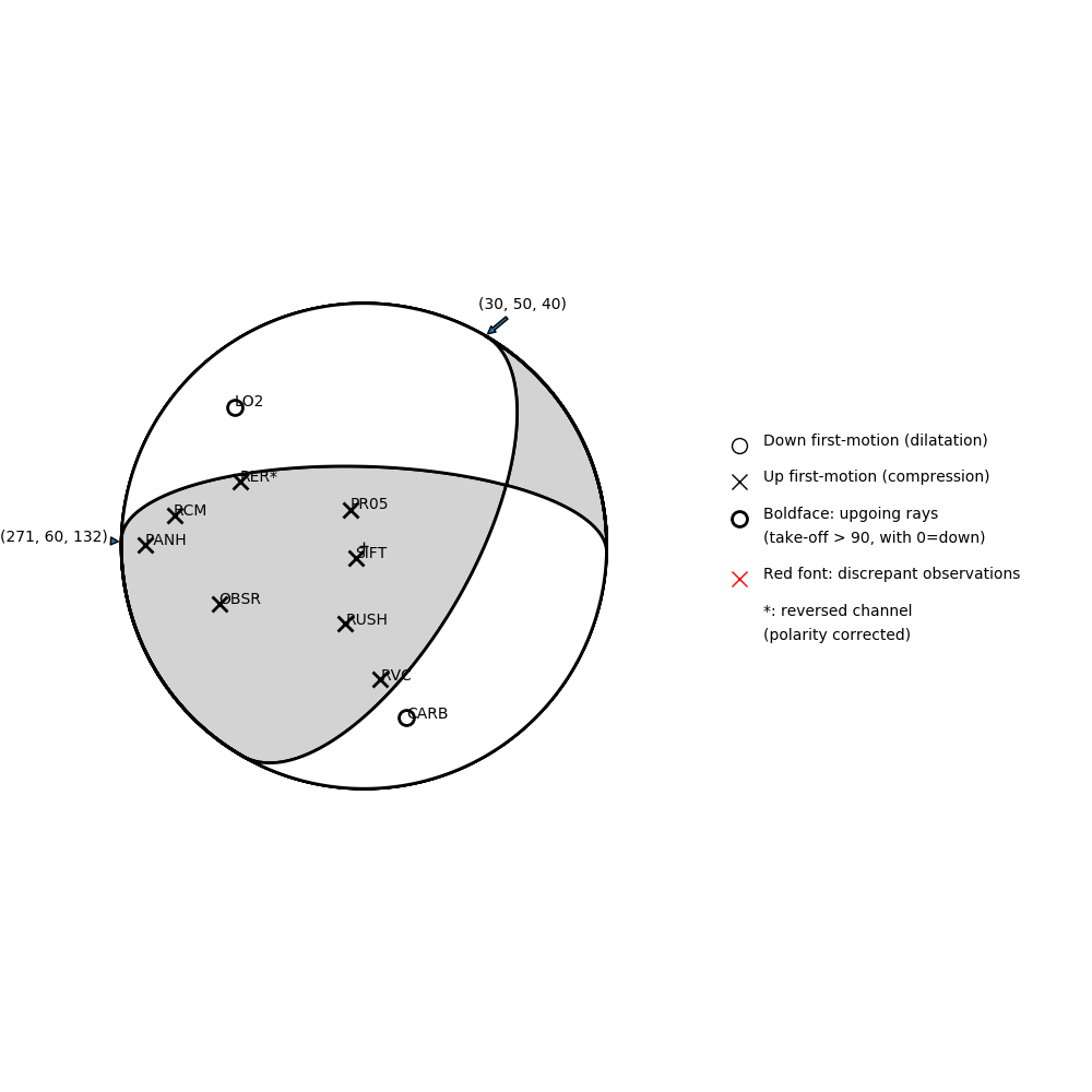
Number of P First motions: 10
| Plane A | Plane B | Uncertainty | |
|---|---|---|---|
| Strike | 30 | 271 | 25 |
| Dip | 50 | 60 | 25 |
| Rake | 40 | 132 | 10 |
Discrepant Stations
Stations whose observed first-motion does not match the predicted first-motion from the focal mechanism.| Station | Network | Channel | Polarity | Quality |
|---|---|---|---|---|
No items. | ||||