M1.0 earthquake - 0.19 mi SE from Mt Rainier, WA
Status: Reviewed
0 Felt ReportsReport your experience
Magnitude1.0Time2021/02/11 10:07:08 PM UTCDepth1.08 miCoordinates46.8523, -121.7568ID61703497
Origin
Statistics on estimate of an earthquake's location and time. For more info, see Earthquake Terminology.Orid
3151408Magnitude
1.02Time
1613081255.3099995Latitude
46.85233Longitude
-121.75683Depth
1.08 miLocation Quality
ExcellentEvent ID
61703497Event Type
eqGtype
lHorizontal Uncertainty
0.13 miDepth Uncertainty
0.39 miAzimuthal Gap
73 degNumber of Phases
28RMS Misfit
0.09Focal Mechanisms
Describes the fault orientation and slip direction of an earthquake and are generated using first motion (up or down) observations.Solution 1
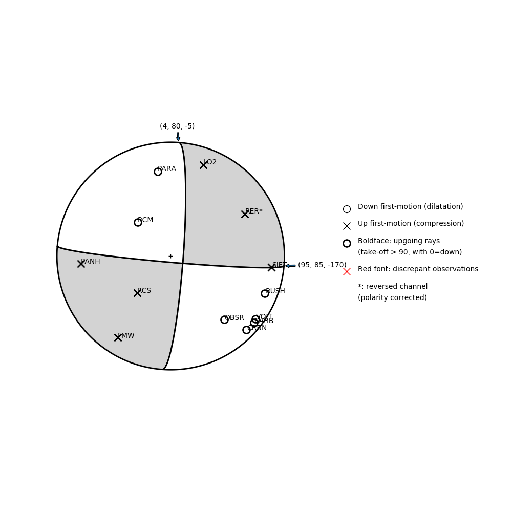
Number of P First motions: 13
| Plane A | Plane B | Uncertainty | |
|---|---|---|---|
| Strike | 95 | 4 | 15 |
| Dip | 85 | 80 | 38 |
| Rake | -170 | -5 | 35 |
Discrepant Stations
Stations whose observed first-motion does not match the predicted first-motion from the focal mechanism.| Station | Network | Channel | Polarity | Quality |
|---|---|---|---|---|
No items. | ||||
Solution 2
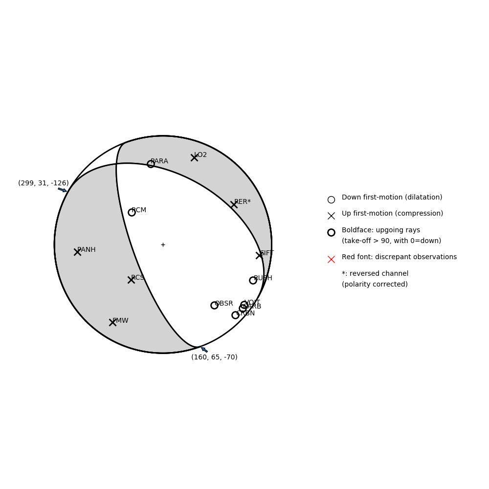
Number of P First motions: 13
| Plane A | Plane B | Uncertainty | |
|---|---|---|---|
| Strike | 160 | 299 | 15 |
| Dip | 65 | 31 | 5 |
| Rake | -70 | -126 | 10 |
Discrepant Stations
Stations whose observed first-motion does not match the predicted first-motion from the focal mechanism.| Station | Network | Channel | Polarity | Quality |
|---|---|---|---|---|
No items. | ||||