M1.5 earthquake - 6.59 mi WNW from Mt Rainier, WA
Status: Reviewed
0 Felt ReportsReport your experience
Magnitude1.5Time2021/02/05 11:34:41 AM UTCDepth5.22 miCoordinates46.8793, -121.8942ID61712021
Origin
Statistics on estimate of an earthquake's location and time. For more info, see Earthquake Terminology.Orid
3150888Magnitude
1.50Time
1612524908.4699974Latitude
46.87933Longitude
-121.89417Depth
5.22 miLocation Quality
ExcellentEvent ID
61712021Event Type
eqGtype
lHorizontal Uncertainty
0.14 miDepth Uncertainty
0.14 miAzimuthal Gap
56 degNumber of Phases
42RMS Misfit
0.13Focal Mechanisms
Describes the fault orientation and slip direction of an earthquake and are generated using first motion (up or down) observations.Solution 1
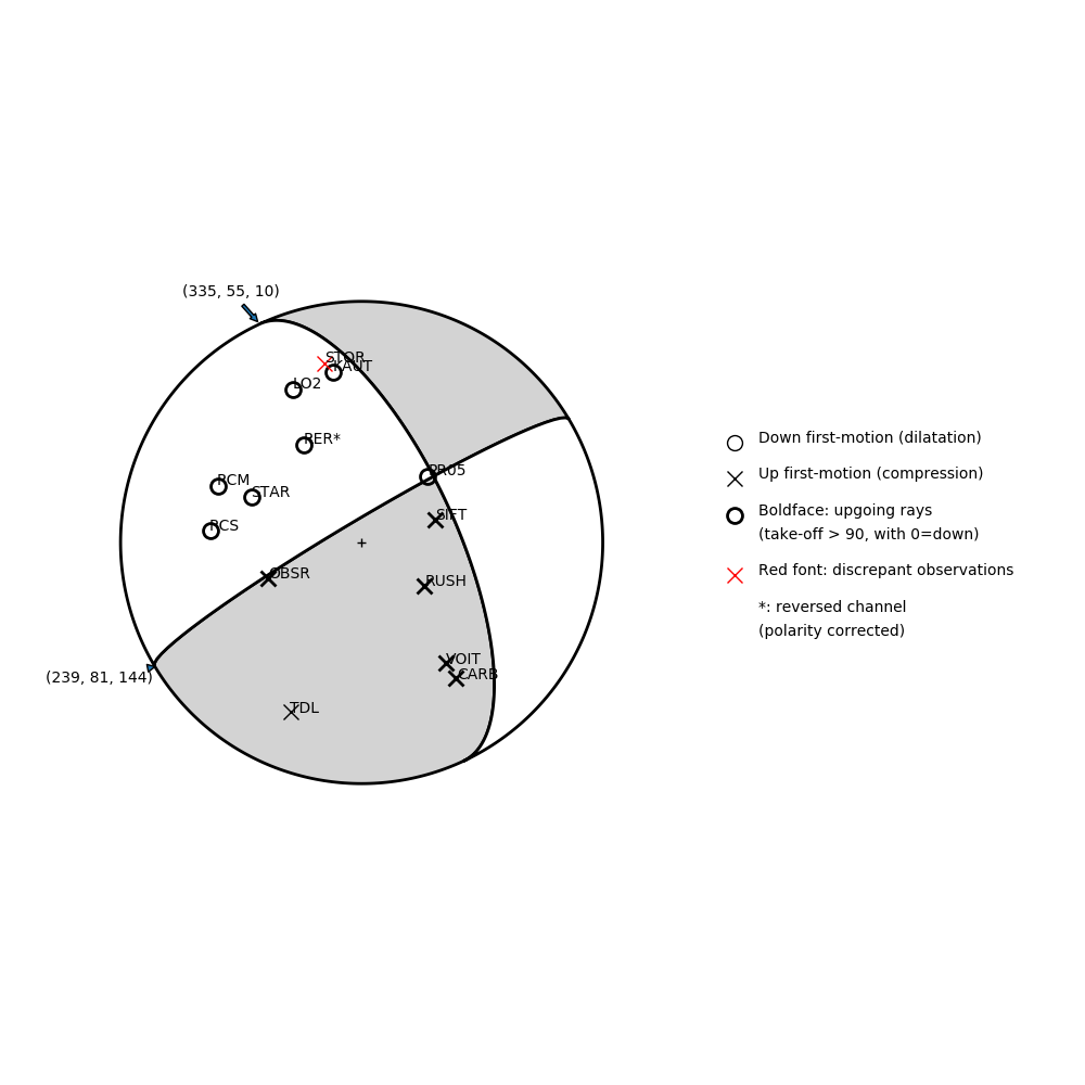
Number of P First motions: 14
| Plane A | Plane B | Uncertainty | |
|---|---|---|---|
| Strike | 335 | 239 | 30 |
| Dip | 55 | 81 | 43 |
| Rake | 10 | 144 | 25 |
Discrepant Stations
Stations whose observed first-motion does not match the predicted first-motion from the focal mechanism.| Station | Network | Channel | Polarity | Quality |
|---|---|---|---|---|
| STOR | UW | HHZ | U | 0.9243 |
Solution 2
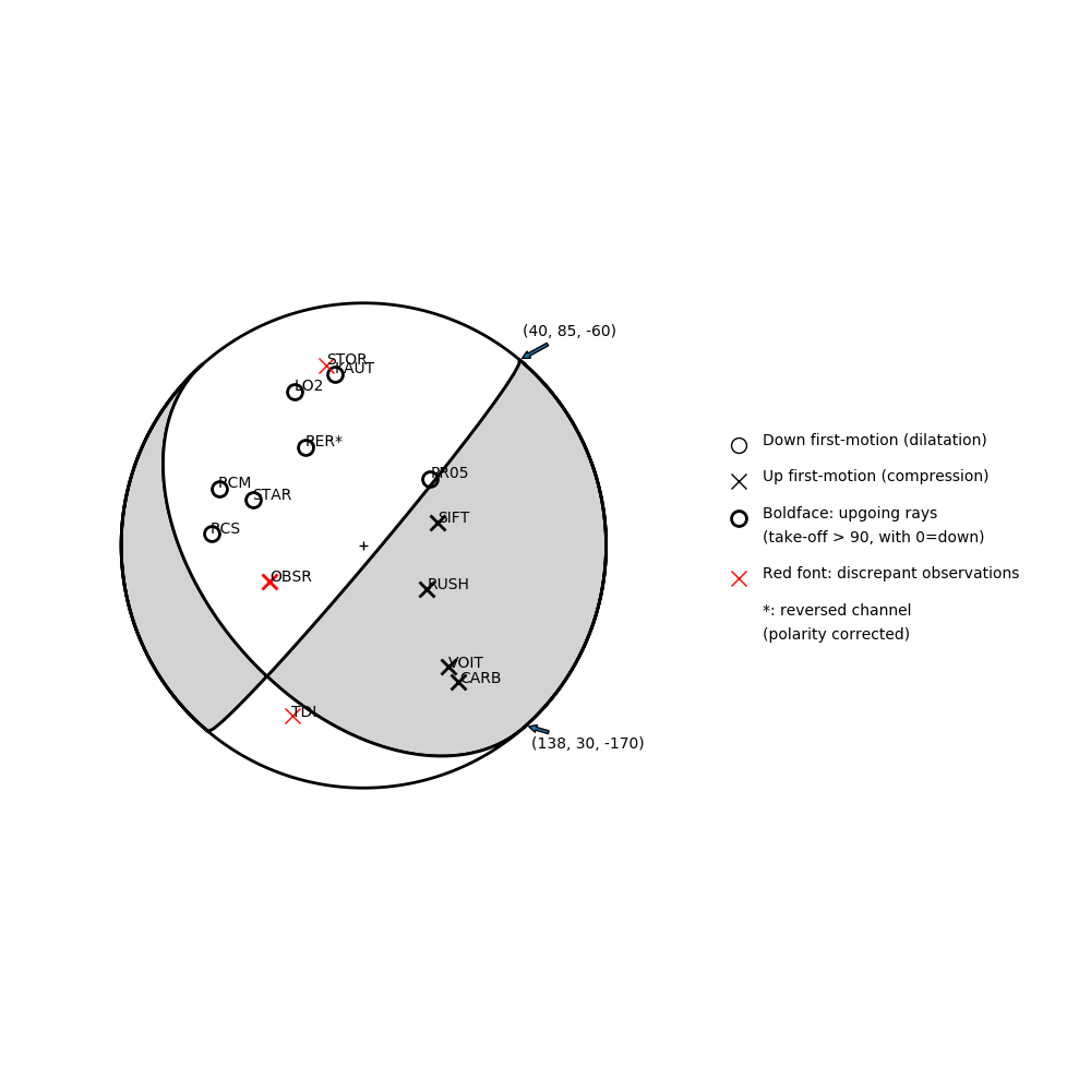
Number of P First motions: 14
| Plane A | Plane B | Uncertainty | |
|---|---|---|---|
| Strike | 40 | 138 | 18 |
| Dip | 85 | 30 | 10 |
| Rake | -60 | -170 | 15 |
Discrepant Stations
Stations whose observed first-motion does not match the predicted first-motion from the focal mechanism.| Station | Network | Channel | Polarity | Quality |
|---|---|---|---|---|
| OBSR | CC | BHZ | U | 0.9771 |
| STOR | UW | HHZ | U | 0.9243 |
| TDL | UW | EHZ | U | 0.9243 |