M0.8 earthquake - 10.69 mi WSW from Mt Rainier, WA
Status: Reviewed
0 Felt ReportsReport your experience
Magnitude0.8Time2021/11/05 06:03:31 PM UTCDepth2.31 miCoordinates46.767, -121.9472ID61786487
Origin
Statistics on estimate of an earthquake's location and time. For more info, see Earthquake Terminology.Orid
3175018Magnitude
0.81Time
1636135438.67Latitude
46.76700Longitude
-121.94717Depth
2.31 miLocation Quality
ExcellentEvent ID
61786487Event Type
eqGtype
lHorizontal Uncertainty
0.27 miDepth Uncertainty
0.5 miAzimuthal Gap
211 degNumber of Phases
22RMS Misfit
0.09Focal Mechanisms
Describes the fault orientation and slip direction of an earthquake and are generated using first motion (up or down) observations.Solution 1
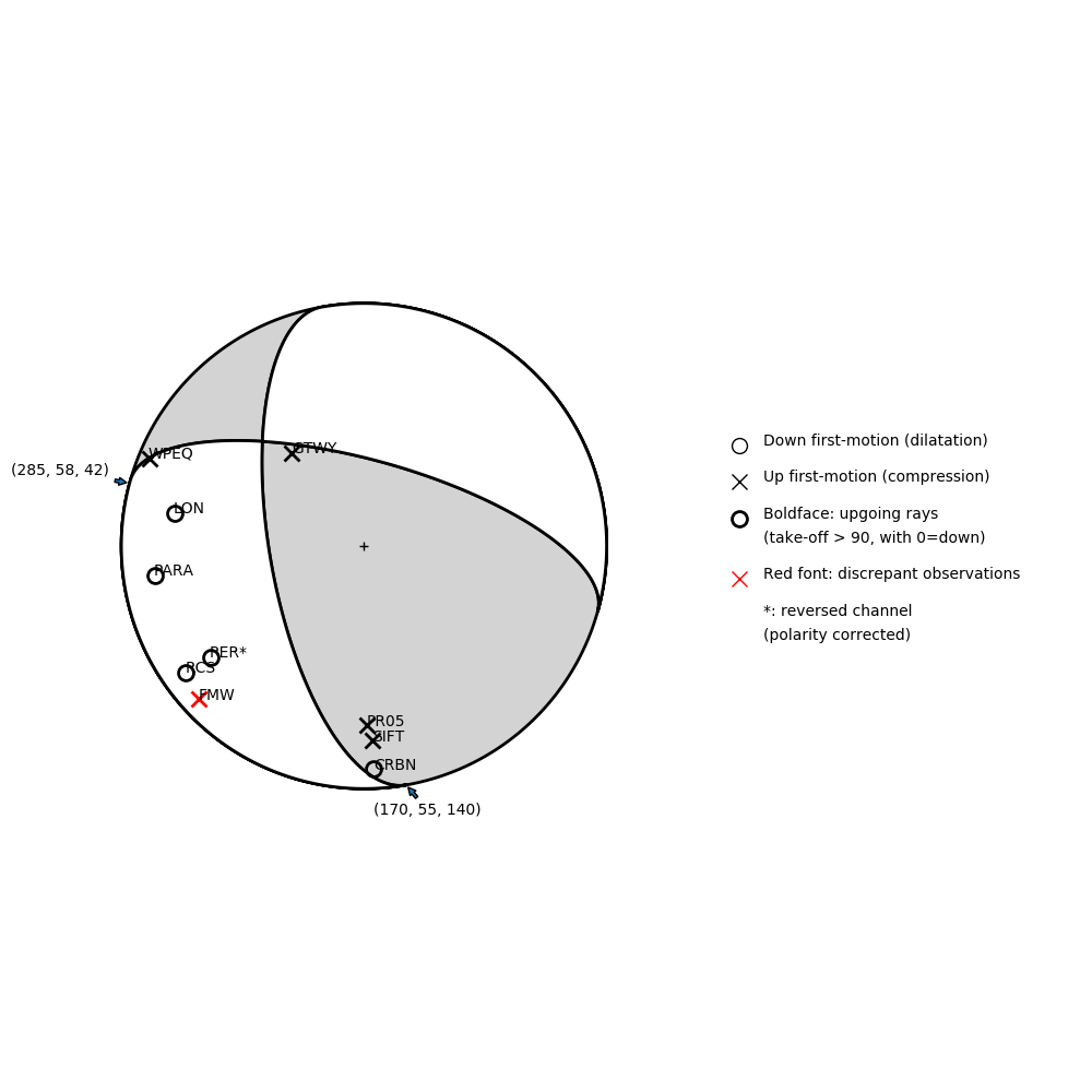
Number of P First motions: 10
| Plane A | Plane B | Uncertainty | |
|---|---|---|---|
| Strike | 170 | 285 | 23 |
| Dip | 55 | 58 | 23 |
| Rake | 140 | 42 | 55 |
Discrepant Stations
Stations whose observed first-motion does not match the predicted first-motion from the focal mechanism.| Station | Network | Channel | Polarity | Quality |
|---|---|---|---|---|
| FMW | UW | HHZ | U | 0.9243 |
Solution 2
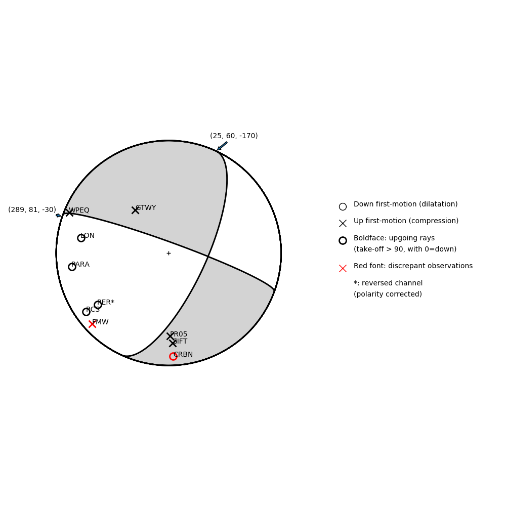
Number of P First motions: 10
| Plane A | Plane B | Uncertainty | |
|---|---|---|---|
| Strike | 25 | 289 | 20 |
| Dip | 60 | 81 | 43 |
| Rake | -170 | -30 | 50 |
Discrepant Stations
Stations whose observed first-motion does not match the predicted first-motion from the focal mechanism.| Station | Network | Channel | Polarity | Quality |
|---|---|---|---|---|
| CRBN | CC | BHZ | D | 0.9243 |
| FMW | UW | HHZ | U | 0.9243 |