M1.0 earthquake - 10.87 mi SW from Mt Rainier, WA
Status: Reviewed
0 Felt ReportsReport your experience
Magnitude1.0Time2024/12/23 07:21:35 PM UTCDepth-0.48 miCoordinates46.7105, -121.8562ID62060347
Origin
Statistics on estimate of an earthquake's location and time. For more info, see Earthquake Terminology.Orid
3303918Magnitude
1.00Time
1734981722.6899986Latitude
46.71050Longitude
-121.85617Depth
-0.48 miLocation Quality
ExcellentEvent ID
62060347Event Type
eqGtype
lHorizontal Uncertainty
0.29 miDepth Uncertainty
0.27 miAzimuthal Gap
223 degNumber of Phases
41RMS Misfit
0.14Focal Mechanisms
Describes the fault orientation and slip direction of an earthquake and are generated using first motion (up or down) observations.Solution 1
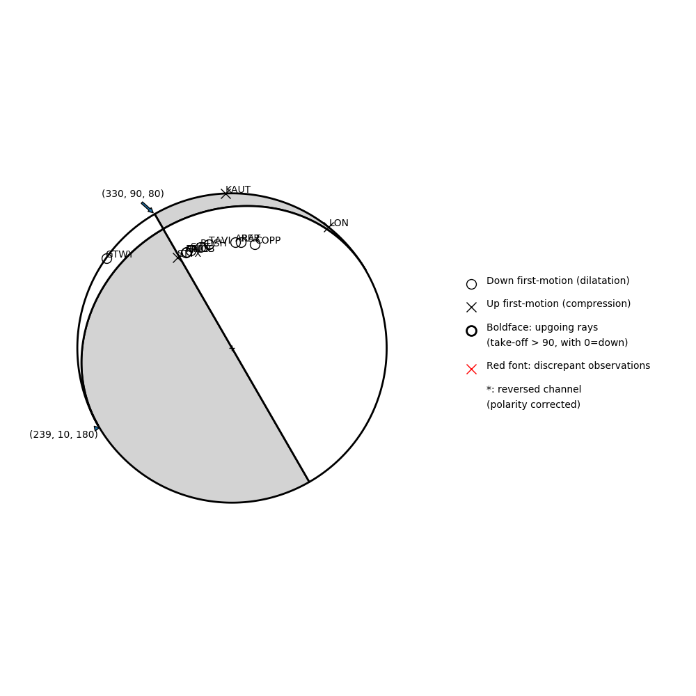
Number of P First motions: 12
| Plane A | Plane B | Uncertainty | |
|---|---|---|---|
| Strike | 330 | 239 | 70 |
| Dip | 90 | 10 | 15 |
| Rake | 80 | 180 | 20 |
Discrepant Stations
Stations whose observed first-motion does not match the predicted first-motion from the focal mechanism.| Station | Network | Channel | Polarity | Quality |
|---|---|---|---|---|
No items. | ||||