M1.4 earthquake - 10.75 mi N from Tacoma, WA
Status: Reviewed
0 Felt ReportsReport your experience
Magnitude1.4Time2025/03/18 07:01:25 AM UTCDepth13.32 miCoordinates47.3908, -122.4643ID62074497
Origin
Statistics on estimate of an earthquake's location and time. For more info, see Earthquake Terminology.Orid
3314848Magnitude
1.41Time
1742281312.3400002Latitude
47.39083Longitude
-122.46433Depth
13.32 miLocation Quality
ExcellentEvent ID
62074497Event Type
eqGtype
lHorizontal Uncertainty
0.18 miDepth Uncertainty
0.3 miAzimuthal Gap
45 degNumber of Phases
50RMS Misfit
0.11Focal Mechanisms
Describes the fault orientation and slip direction of an earthquake and are generated using first motion (up or down) observations.Solution 1
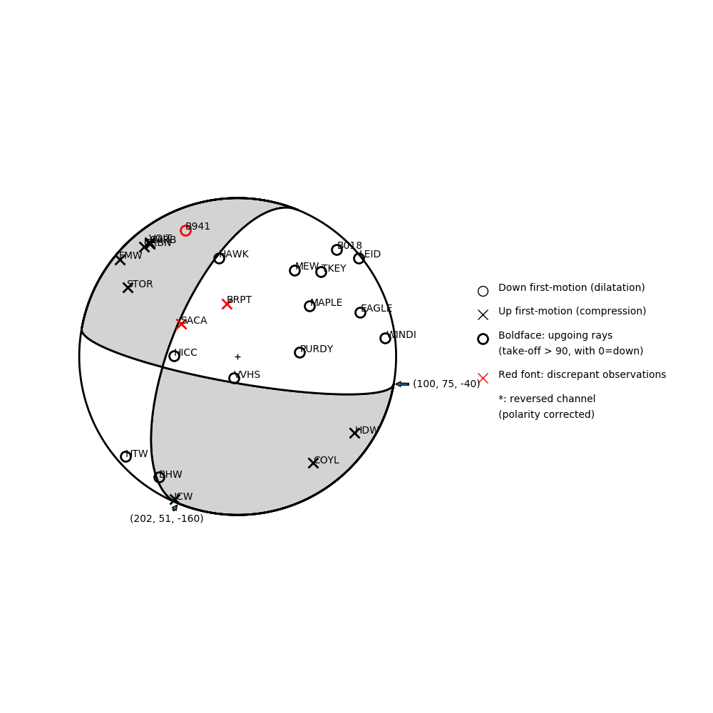
Number of P First motions: 24
| Plane A | Plane B | Uncertainty | |
|---|---|---|---|
| Strike | 100 | 202 | 28 |
| Dip | 75 | 51 | 43 |
| Rake | -40 | -160 | 50 |
Discrepant Stations
Stations whose observed first-motion does not match the predicted first-motion from the focal mechanism.| Station | Network | Channel | Polarity | Quality |
|---|---|---|---|---|
| BRPT | UW | HNZ | U | 0.9243 |
| SACA | UW | HNZ | U | 0.9243 |
| B941 | PB | EHZ | D | 0.9771 |