M0.7 earthquake - 9.69 mi W from Mt Rainier, WA
Status: Reviewed
0 Felt ReportsReport your experience
Magnitude0.7Time2025/03/03 10:39:17 AM UTCDepth3.5 miCoordinates46.8012, -121.9502ID62078886
Origin
Statistics on estimate of an earthquake's location and time. For more info, see Earthquake Terminology.Orid
3311998Magnitude
0.74Time
1740998384.2700005Latitude
46.80117Longitude
-121.95017Depth
3.5 miLocation Quality
ExcellentEvent ID
62078886Event Type
eqGtype
lHorizontal Uncertainty
0.13 miDepth Uncertainty
0.23 miAzimuthal Gap
100 degNumber of Phases
43RMS Misfit
0.07Focal Mechanisms
Describes the fault orientation and slip direction of an earthquake and are generated using first motion (up or down) observations.Solution 1
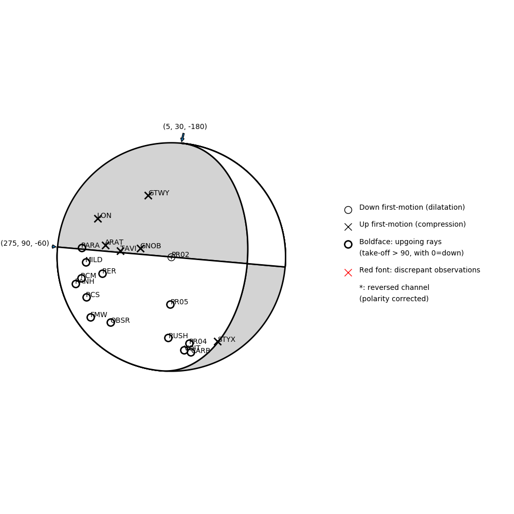
Number of P First motions: 20
| Plane A | Plane B | Uncertainty | |
|---|---|---|---|
| Strike | 275 | 5 | 20 |
| Dip | 90 | 30 | 20 |
| Rake | -60 | -180 | 40 |
Discrepant Stations
Stations whose observed first-motion does not match the predicted first-motion from the focal mechanism.| Station | Network | Channel | Polarity | Quality |
|---|---|---|---|---|
No items. | ||||
Solution 2
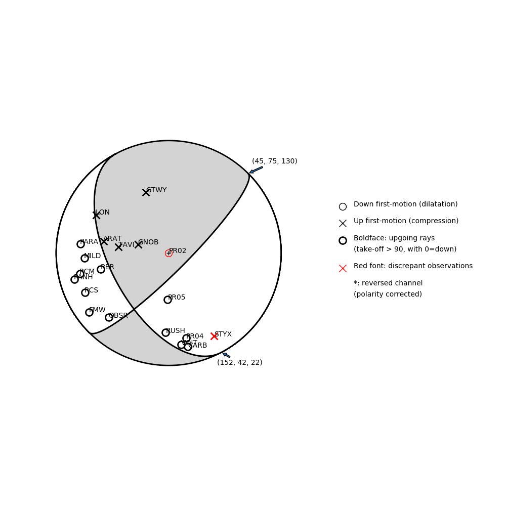
Number of P First motions: 20
| Plane A | Plane B | Uncertainty | |
|---|---|---|---|
| Strike | 45 | 152 | 13 |
| Dip | 75 | 42 | 13 |
| Rake | 130 | 22 | 10 |
Discrepant Stations
Stations whose observed first-motion does not match the predicted first-motion from the focal mechanism.| Station | Network | Channel | Polarity | Quality |
|---|---|---|---|---|
| PR02 | CC | BHZ | D | 0.9243 |
| STYX | CC | BHZ | U | 0.9243 |