M3.9 earthquake - 19.26 mi SE from Port Angeles, WA
Magnitude3.9Time2025/03/06 12:18:24 AM UTCDepth26.32 miCoordinates47.924, -123.1408ID62079456
Origin
Statistics on estimate of an earthquake's location and time. For more info, see Earthquake Terminology.Orid
3312698Magnitude
3.89Time
1741220331.039999Latitude
47.92400Longitude
-123.14083Depth
26.32 miLocation Quality
ExcellentEvent ID
62079456Event Type
eqGtype
lHorizontal Uncertainty
0.11 miDepth Uncertainty
0.23 miAzimuthal Gap
19 degNumber of Phases
122RMS Misfit
0.14Focal Mechanisms
Describes the fault orientation and slip direction of an earthquake and are generated using first motion (up or down) observations.Solution 1
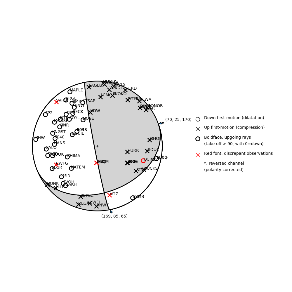
Number of P First motions: 68
| Plane A | Plane B | Uncertainty | |
|---|---|---|---|
| Strike | 70 | 169 | 13 |
| Dip | 25 | 85 | 18 |
| Rake | 170 | 65 | 20 |
Discrepant Stations
Stations whose observed first-motion does not match the predicted first-motion from the focal mechanism.| Station | Network | Channel | Polarity | Quality |
|---|---|---|---|---|
| B001 | PB | EHZ | U | 0.9771 |
| OSQM | UW | HHZ | U | 0.9771 |
| CWFG | UW | HNZ | U | 0.9771 |
| OCRES | UW | HNZ | D | 0.9243 |
| VGZ | CN | HNZ | U | 0.9771 |
| VVHS | UW | EHZ | U | 0.9771 |
Solution 2
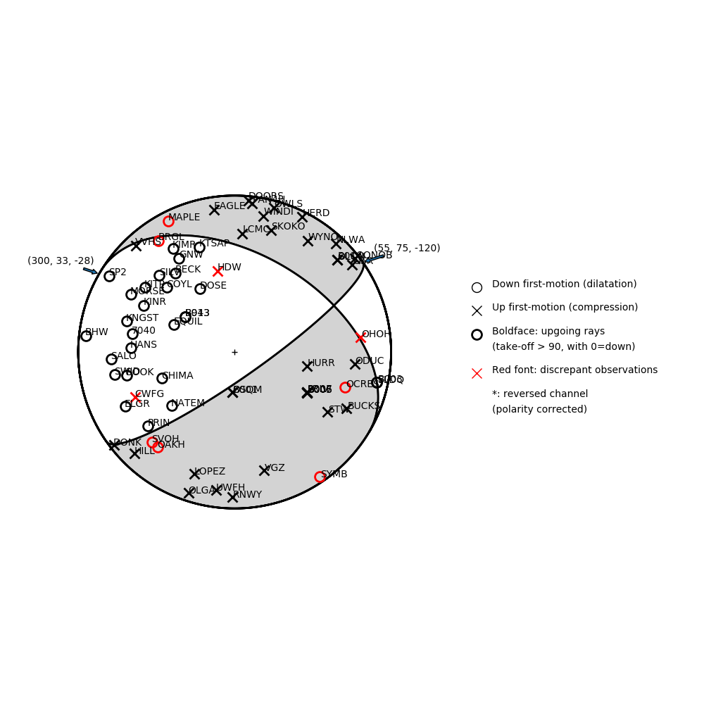
Number of P First motions: 68
| Plane A | Plane B | Uncertainty | |
|---|---|---|---|
| Strike | 55 | 300 | 13 |
| Dip | 75 | 33 | 10 |
| Rake | -120 | -28 | 15 |
Discrepant Stations
Stations whose observed first-motion does not match the predicted first-motion from the focal mechanism.| Station | Network | Channel | Polarity | Quality |
|---|---|---|---|---|
| HDW | UW | HHZ | U | 0.9771 |
| CWFG | UW | HNZ | U | 0.9771 |
| OCRES | UW | HNZ | D | 0.9243 |
| OAKH | UW | HNZ | D | 0.9771 |
| SVOH | UW | HNZ | D | 0.9243 |
| OHOH | UW | HHZ | U | 0.9771 |
| BRGL | UW | HNZ | D | 0.9771 |
| MAPLE | UW | HHZ | D | 0.9243 |
| SYMB | CN | HHZ | D | 0.9243 |