M2.4 earthquake - 9.2 mi NW from Hanford-200W, WA
Status: Reviewed
0 Felt ReportsReport your experience
Magnitude2.4Time2025/04/15 11:55:13 PM UTCDepth4.75 miCoordinates46.6183, -119.7948ID62091766
Origin
Statistics on estimate of an earthquake's location and time. For more info, see Earthquake Terminology.Orid
3319238Magnitude
2.36Time
1744761340.0699997Latitude
46.61833Longitude
-119.79483Depth
4.75 miLocation Quality
ExcellentEvent ID
62091766Event Type
eqGtype
lHorizontal Uncertainty
0.1 miDepth Uncertainty
0.06 miAzimuthal Gap
26 degNumber of Phases
53RMS Misfit
0.11Focal Mechanisms
Describes the fault orientation and slip direction of an earthquake and are generated using first motion (up or down) observations.Solution 1
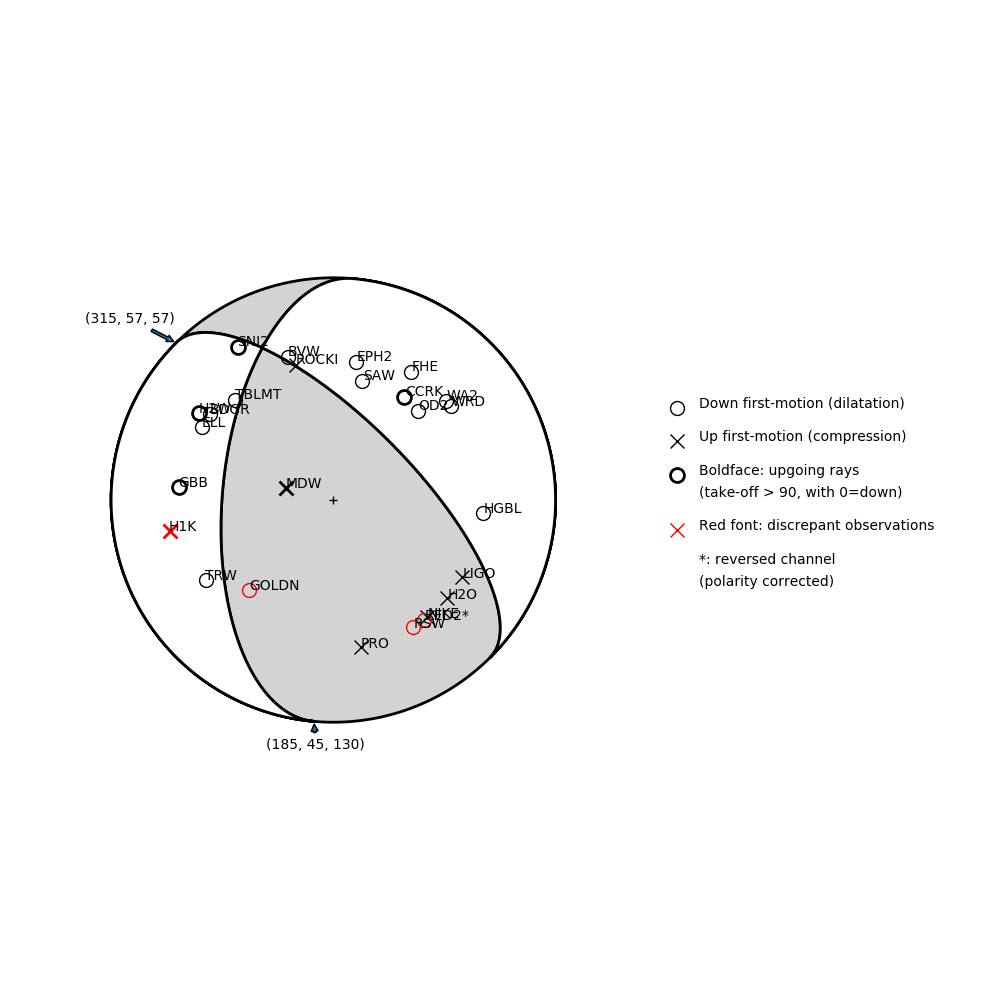
Number of P First motions: 26
| Plane A | Plane B | Uncertainty | |
|---|---|---|---|
| Strike | 185 | 315 | 43 |
| Dip | 45 | 57 | 30 |
| Rake | 130 | 57 | 35 |
Discrepant Stations
Stations whose observed first-motion does not match the predicted first-motion from the focal mechanism.| Station | Network | Channel | Polarity | Quality |
|---|---|---|---|---|
| H1K | UW | HNZ | U | 0.9243 |
| RSW | UW | EHZ | D | 0.9243 |
| RED2 | UW | EHZ | D | 0.9243 |
| GOLDN | UW | HHZ | D | 0.9243 |