M1.9 earthquake - 6.4 mi ESE from Forks, WA
Status: Reviewed
1 Felt ReportsReport your experience
Magnitude1.9Time2025/04/20 03:57:34 PM UTCDepth5.29 miCoordinates47.9358, -124.246ID62094911
Origin
Statistics on estimate of an earthquake's location and time. For more info, see Earthquake Terminology.Orid
3320128Magnitude
1.88Time
1745164681.7299995Latitude
47.93583Longitude
-124.24600Depth
5.29 miLocation Quality
ExcellentEvent ID
62094911Event Type
eqGtype
lHorizontal Uncertainty
0.35 miDepth Uncertainty
1.09 miAzimuthal Gap
60 degNumber of Phases
26RMS Misfit
0.39Focal Mechanisms
Describes the fault orientation and slip direction of an earthquake and are generated using first motion (up or down) observations.Solution 1
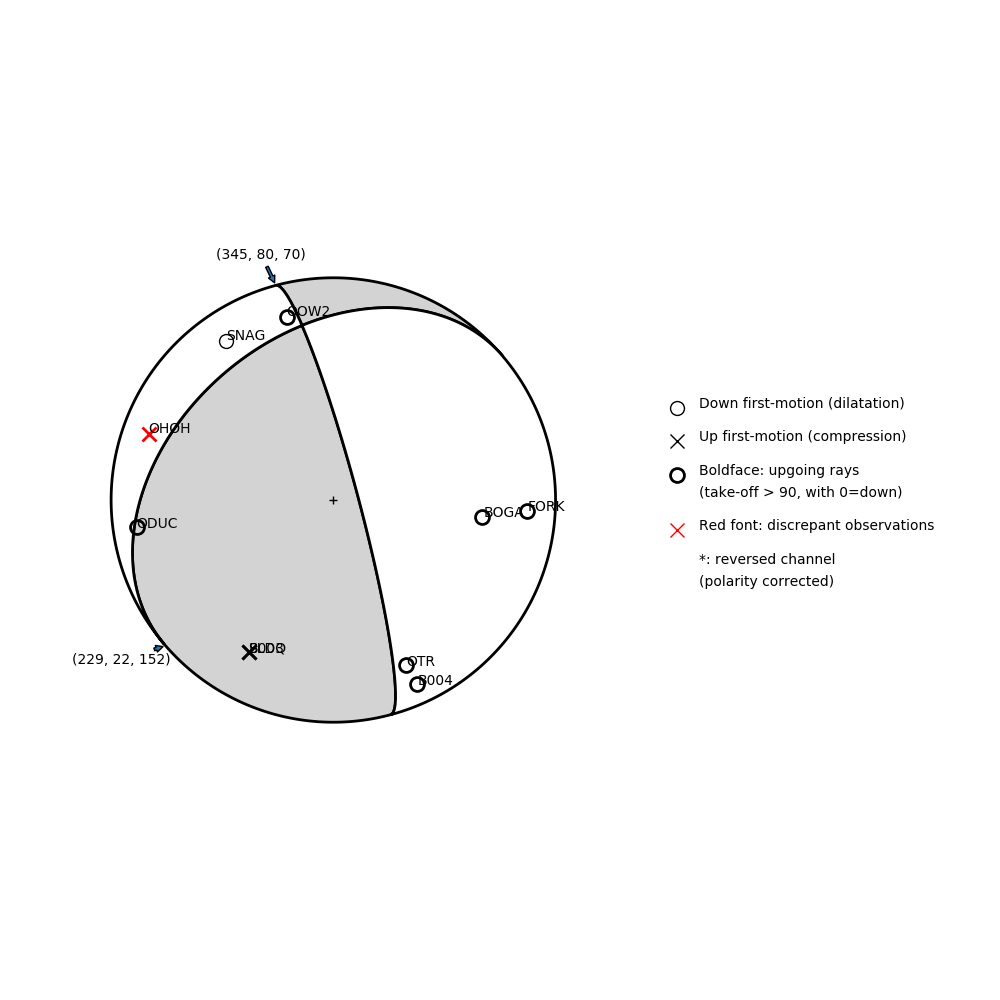
Number of P First motions: 10
| Plane A | Plane B | Uncertainty | |
|---|---|---|---|
| Strike | 345 | 229 | 25 |
| Dip | 80 | 22 | 30 |
| Rake | 70 | 152 | 30 |
Discrepant Stations
Stations whose observed first-motion does not match the predicted first-motion from the focal mechanism.| Station | Network | Channel | Polarity | Quality |
|---|---|---|---|---|
| OHOH | UW | HHZ | U | 0.9243 |