M1.7 earthquake - 39.77 mi SSW from Forks, WA
Status: Reviewed
0 Felt ReportsReport your experience
Magnitude1.7Time2025/05/09 01:33:02 PM UTCDepth21.38 miCoordinates47.3722, -124.4013ID62096087
Origin
Statistics on estimate of an earthquake's location and time. For more info, see Earthquake Terminology.Orid
3323813Magnitude
1.72Time
1746797609.9299998Latitude
47.37217Longitude
-124.40133Depth
21.38 miLocation Quality
ExcellentEvent ID
62096087Event Type
eqGtype
lHorizontal Uncertainty
0.5 miDepth Uncertainty
0.34 miAzimuthal Gap
199 degNumber of Phases
28RMS Misfit
0.13Focal Mechanisms
Describes the fault orientation and slip direction of an earthquake and are generated using first motion (up or down) observations.Solution 1
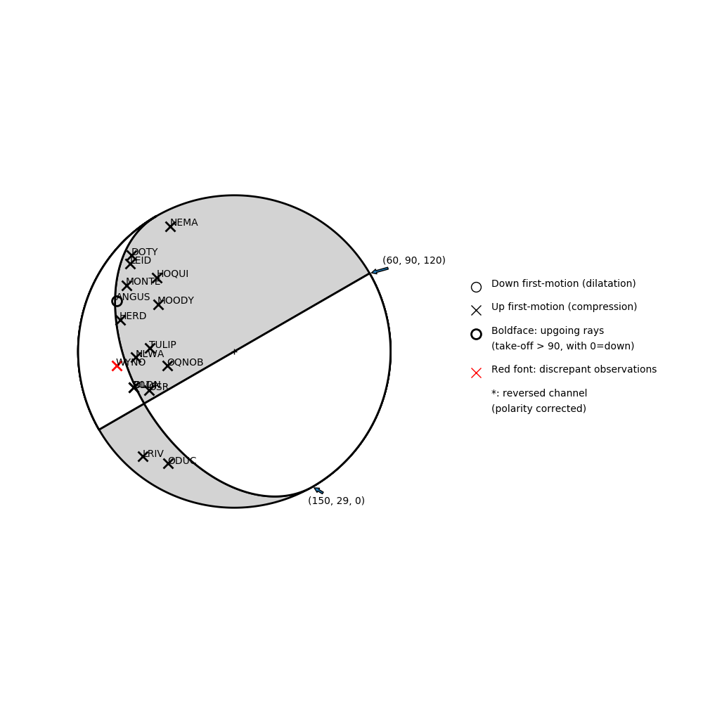
Number of P First motions: 17
| Plane A | Plane B | Uncertainty | |
|---|---|---|---|
| Strike | 60 | 150 | 33 |
| Dip | 90 | 29 | 10 |
| Rake | 120 | 0 | 40 |
Discrepant Stations
Stations whose observed first-motion does not match the predicted first-motion from the focal mechanism.| Station | Network | Channel | Polarity | Quality |
|---|---|---|---|---|
| WYNO | UW | HHZ | U | 0.9243 |