M1.5 earthquake - 10.19 mi ENE from Friday Harbor, WA
Status: Reviewed
0 Felt ReportsReport your experience
Magnitude1.5Time2025/05/23 09:55:09 AM UTCDepth10.56 miCoordinates48.6085, -122.8128ID62114691
Origin
Statistics on estimate of an earthquake's location and time. For more info, see Earthquake Terminology.Orid
3325613Magnitude
1.49Time
1747994136.5100002Latitude
48.60850Longitude
-122.81283Depth
10.56 miLocation Quality
ExcellentEvent ID
62114691Event Type
eqGtype
lHorizontal Uncertainty
0.17 miDepth Uncertainty
0.21 miAzimuthal Gap
43 degNumber of Phases
38RMS Misfit
0.11Focal Mechanisms
Describes the fault orientation and slip direction of an earthquake and are generated using first motion (up or down) observations.Solution 1
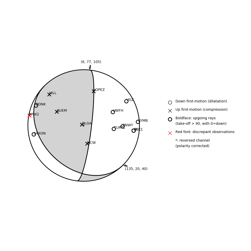
Number of P First motions: 15
| Plane A | Plane B | Uncertainty | |
|---|---|---|---|
| Strike | 135 | 6 | 30 |
| Dip | 20 | 77 | 28 |
| Rake | 40 | 105 | 35 |
Discrepant Stations
Stations whose observed first-motion does not match the predicted first-motion from the focal mechanism.| Station | Network | Channel | Polarity | Quality |
|---|---|---|---|---|
| RPW2 | UW | HHZ | U | 0.9243 |