M3.0 earthquake - 2.36 mi WNW from Mount Vernon, WA
Status: Reviewed
64 Felt ReportsReport your experience
Magnitude3.0Time2025/06/03 08:59:51 AM UTCDepth6.15 miCoordinates48.4227, -122.389ID62121826
Origin
Statistics on estimate of an earthquake's location and time. For more info, see Earthquake Terminology.Orid
3327223Magnitude
3.05Time
1748941218.869999Latitude
48.42267Longitude
-122.38900Depth
6.15 miLocation Quality
ExcellentEvent ID
62121826Event Type
eqGtype
lHorizontal Uncertainty
0.11 miDepth Uncertainty
0.32 miAzimuthal Gap
25 degNumber of Phases
125RMS Misfit
0.25Focal Mechanisms
Describes the fault orientation and slip direction of an earthquake and are generated using first motion (up or down) observations.Solution 1
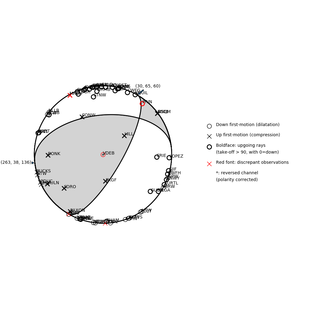
Number of P First motions: 68
| Plane A | Plane B | Uncertainty | |
|---|---|---|---|
| Strike | 30 | 263 | 20 |
| Dip | 65 | 38 | 28 |
| Rake | 60 | 136 | 25 |
Discrepant Stations
Stations whose observed first-motion does not match the predicted first-motion from the focal mechanism.| Station | Network | Channel | Polarity | Quality |
|---|---|---|---|---|
| VDEB | CN | HHZ | D | 0.9771 |
| PRIN | UW | HHZ | D | 0.9243 |
| MACH | UW | HNZ | U | 0.9771 |
| CTR | UW | HNZ | U | 0.9243 |
| HDW | UW | HHZ | U | 0.9243 |