M0.2 earthquake - 12.3 mi E from Eatonville, WA
Status: Reviewed
0 Felt ReportsReport your experience
Magnitude0.2Time2025/06/04 06:38:48 PM UTCDepth7.41 miCoordinates46.903, -122.011ID62123191
Origin
Statistics on estimate of an earthquake's location and time. For more info, see Earthquake Terminology.Orid
3327933Magnitude
0.23Time
1749062355.7000008Latitude
46.90300Longitude
-122.01100Depth
7.41 miLocation Quality
ExcellentEvent ID
62123191Event Type
eqGtype
lHorizontal Uncertainty
0.36 miDepth Uncertainty
0.3 miAzimuthal Gap
174 degNumber of Phases
30RMS Misfit
0.11Focal Mechanisms
Describes the fault orientation and slip direction of an earthquake and are generated using first motion (up or down) observations.Solution 1
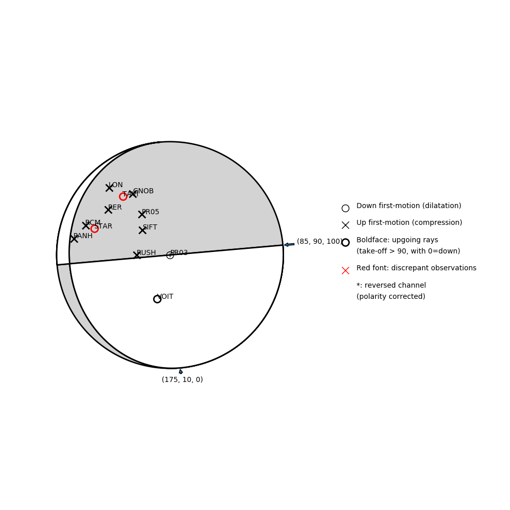
Number of P First motions: 12
| Plane A | Plane B | Uncertainty | |
|---|---|---|---|
| Strike | 85 | 175 | 55 |
| Dip | 90 | 10 | 23 |
| Rake | 100 | 0 | 65 |
Discrepant Stations
Stations whose observed first-motion does not match the predicted first-motion from the focal mechanism.| Station | Network | Channel | Polarity | Quality |
|---|---|---|---|---|
| TAVI | CC | BHZ | D | 0.9243 |
| STAR | UW | EHZ | D | 0.9243 |
Solution 2
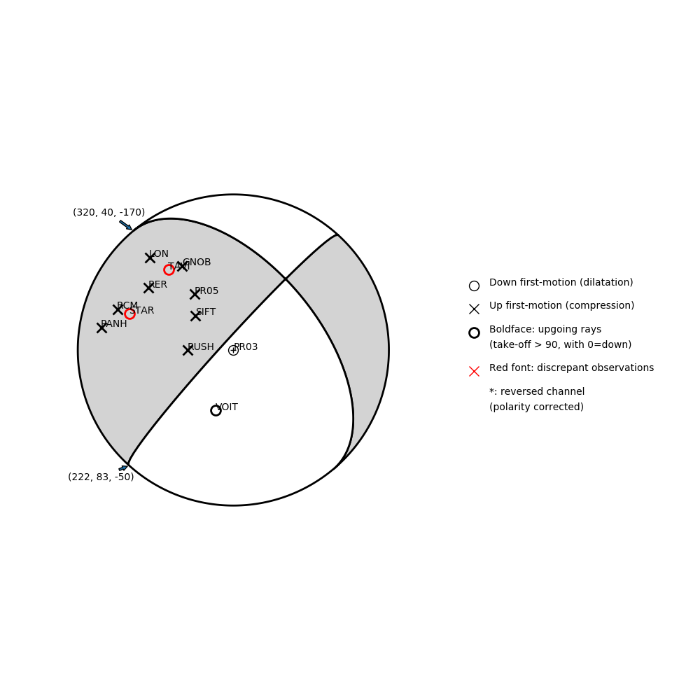
Number of P First motions: 12
| Plane A | Plane B | Uncertainty | |
|---|---|---|---|
| Strike | 320 | 222 | 30 |
| Dip | 40 | 83 | 25 |
| Rake | -170 | -50 | 30 |
Discrepant Stations
Stations whose observed first-motion does not match the predicted first-motion from the focal mechanism.| Station | Network | Channel | Polarity | Quality |
|---|---|---|---|---|
| TAVI | CC | BHZ | D | 0.9243 |
| STAR | UW | EHZ | D | 0.9243 |