M1.3 earthquake - 20.75 mi SE from Forks, WA
Status: Reviewed
0 Felt ReportsReport your experience
Magnitude1.3Time2025/06/17 09:00:15 PM UTCDepth17.71 miCoordinates47.8077, -123.9875ID62130076
Origin
Statistics on estimate of an earthquake's location and time. For more info, see Earthquake Terminology.Orid
3330678Magnitude
1.31Time
1750194042.1799994Latitude
47.80767Longitude
-123.98750Depth
17.71 miLocation Quality
GoodEvent ID
62130076Event Type
eqGtype
lHorizontal Uncertainty
0.7 miDepth Uncertainty
1.24 miAzimuthal Gap
128 degNumber of Phases
23RMS Misfit
0.29Focal Mechanisms
Describes the fault orientation and slip direction of an earthquake and are generated using first motion (up or down) observations.Solution 1
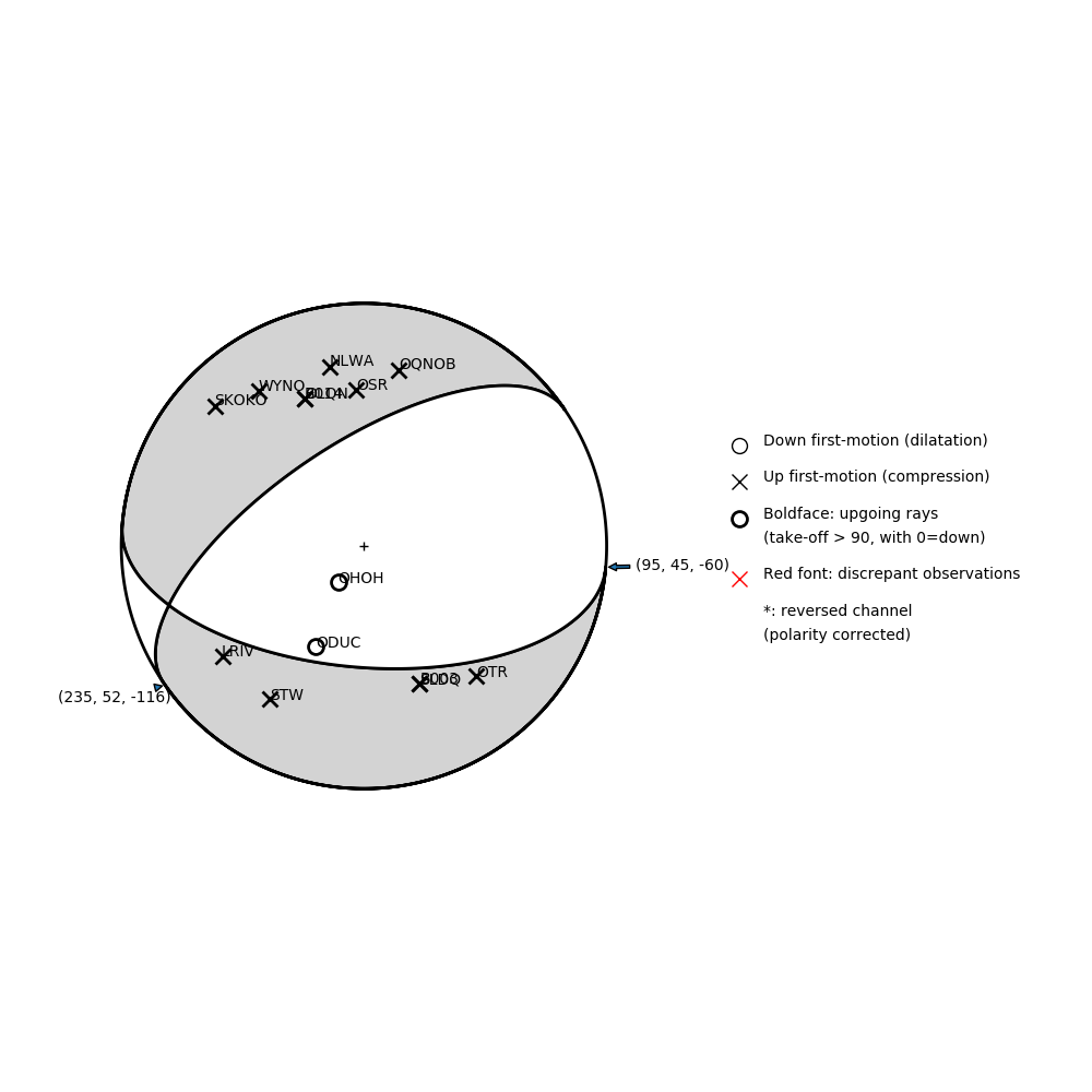
Number of P First motions: 14
| Plane A | Plane B | Uncertainty | |
|---|---|---|---|
| Strike | 95 | 235 | 30 |
| Dip | 45 | 52 | 13 |
| Rake | -60 | -116 | 35 |
Discrepant Stations
Stations whose observed first-motion does not match the predicted first-motion from the focal mechanism.| Station | Network | Channel | Polarity | Quality |
|---|---|---|---|---|
No items. | ||||