M1.9 earthquake - 13.36 mi NNW from Forks, WA
Status: Reviewed
0 Felt ReportsReport your experience
Magnitude1.9Time2025/08/07 02:16:40 PM UTCDepth23.77 miCoordinates48.1202, -124.5135ID62167161
Origin
Statistics on estimate of an earthquake's location and time. For more info, see Earthquake Terminology.Orid
3344613Magnitude
1.94Time
1754576227.5099983Latitude
48.12017Longitude
-124.51350Depth
23.77 miLocation Quality
ExcellentEvent ID
62167161Event Type
eqGtype
lHorizontal Uncertainty
0.29 miDepth Uncertainty
0.35 miAzimuthal Gap
98 degNumber of Phases
33RMS Misfit
0.16Focal Mechanisms
Describes the fault orientation and slip direction of an earthquake and are generated using first motion (up or down) observations.Solution 1
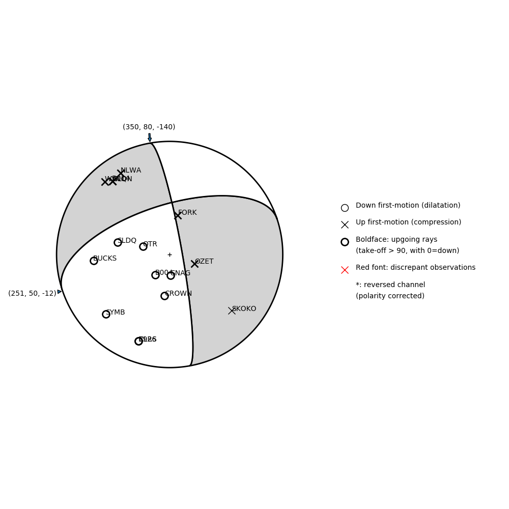
Number of P First motions: 16
| Plane A | Plane B | Uncertainty | |
|---|---|---|---|
| Strike | 350 | 251 | 33 |
| Dip | 80 | 50 | 20 |
| Rake | -140 | -12 | 35 |
Discrepant Stations
Stations whose observed first-motion does not match the predicted first-motion from the focal mechanism.| Station | Network | Channel | Polarity | Quality |
|---|---|---|---|---|
No items. | ||||