M1.4 earthquake - 14.35 mi NNW from Forks, WA
Status: Reviewed
0 Felt ReportsReport your experience
Magnitude1.4Time2025/09/20 03:10:21 AM UTCDepth5.11 miCoordinates48.1362, -124.515ID62191846
Origin
Statistics on estimate of an earthquake's location and time. For more info, see Earthquake Terminology.Orid
3354028Magnitude
1.43Time
1758337848.1800003Latitude
48.13617Longitude
-124.51500Depth
5.11 miLocation Quality
ExcellentEvent ID
62191846Event Type
eqGtype
lHorizontal Uncertainty
0.42 miDepth Uncertainty
0.5 miAzimuthal Gap
167 degNumber of Phases
27RMS Misfit
0.34Focal Mechanisms
Describes the fault orientation and slip direction of an earthquake and are generated using first motion (up or down) observations.Solution 1
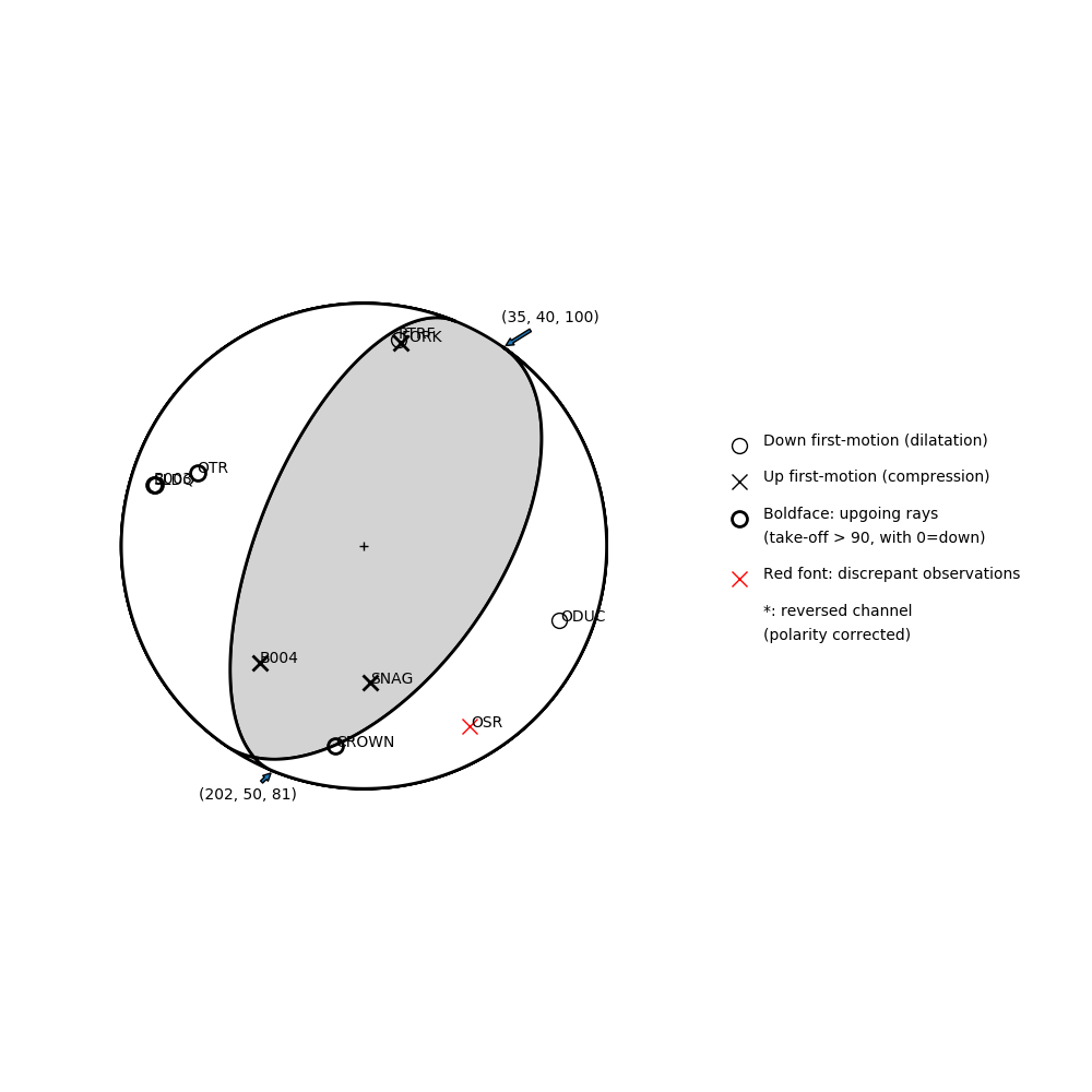
Number of P First motions: 10
| Plane A | Plane B | Uncertainty | |
|---|---|---|---|
| Strike | 35 | 202 | 30 |
| Dip | 40 | 50 | 13 |
| Rake | 100 | 81 | 25 |
Discrepant Stations
Stations whose observed first-motion does not match the predicted first-motion from the focal mechanism.| Station | Network | Channel | Polarity | Quality |
|---|---|---|---|---|
| OSR | UW | HHZ | U | 0.9243 |
Solution 2
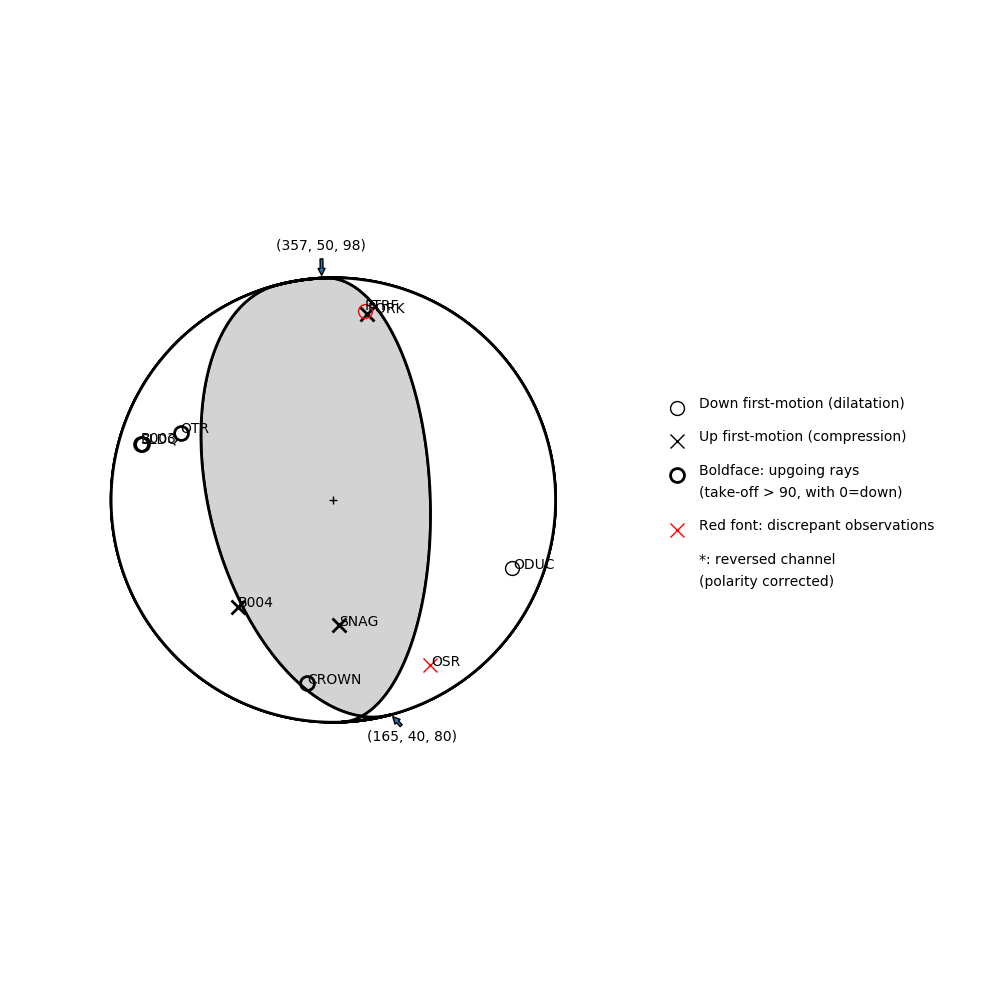
Number of P First motions: 10
| Plane A | Plane B | Uncertainty | |
|---|---|---|---|
| Strike | 165 | 357 | 25 |
| Dip | 40 | 50 | 8 |
| Rake | 80 | 98 | 25 |
Discrepant Stations
Stations whose observed first-motion does not match the predicted first-motion from the focal mechanism.| Station | Network | Channel | Polarity | Quality |
|---|---|---|---|---|
| PTRF | CN | HHZ | D | 0.9771 |
| OSR | UW | HHZ | U | 0.9243 |