M1.6 earthquake - 3.11 mi WSW from Forks, WA
Status: Reviewed
0 Felt ReportsReport your experience
Magnitude1.6Time2025/10/21 08:22:09 AM UTCDepth22.69 miCoordinates47.9262, -124.4408ID62196982
Origin
Statistics on estimate of an earthquake's location and time. For more info, see Earthquake Terminology.Orid
3358468Magnitude
1.58Time
1761034956.6499996Latitude
47.92617Longitude
-124.44083Depth
22.69 miLocation Quality
ExcellentEvent ID
62196982Event Type
eqGtype
lHorizontal Uncertainty
0.26 miDepth Uncertainty
0.35 miAzimuthal Gap
111 degNumber of Phases
34RMS Misfit
0.16Focal Mechanisms
Describes the fault orientation and slip direction of an earthquake and are generated using first motion (up or down) observations.Solution 1
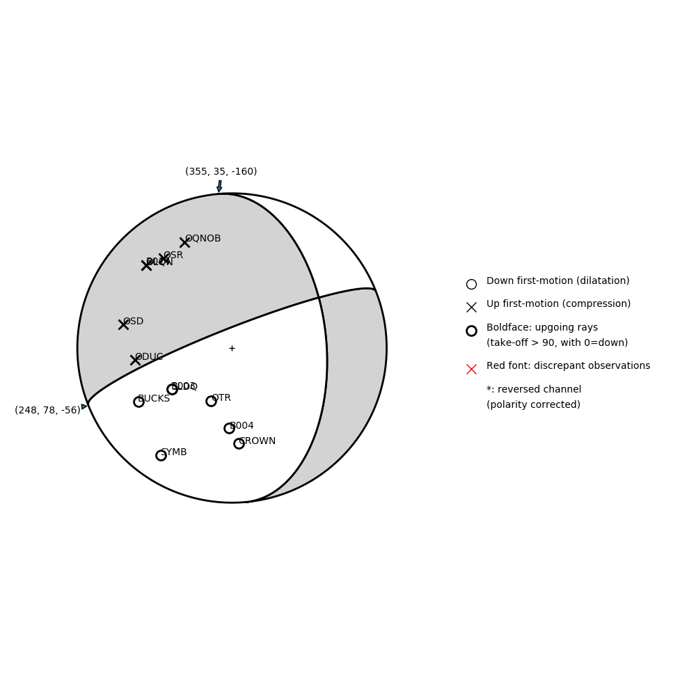
Number of P First motions: 13
| Plane A | Plane B | Uncertainty | |
|---|---|---|---|
| Strike | 355 | 248 | 43 |
| Dip | 35 | 78 | 53 |
| Rake | -160 | -56 | 60 |
Discrepant Stations
Stations whose observed first-motion does not match the predicted first-motion from the focal mechanism.| Station | Network | Channel | Polarity | Quality |
|---|---|---|---|---|
No items. | ||||