M1.9 earthquake - 4.66 mi NE from Maple Valley, WA
Status: Reviewed
0 Felt ReportsReport your experience
Magnitude1.9Time2025/12/07 06:05:54 AM UTCDepth14.45 miCoordinates47.4715, -122.001ID62217226
Origin
Statistics on estimate of an earthquake's location and time. For more info, see Earthquake Terminology.Orid
3365343Magnitude
1.94Time
1765087581.6299973Latitude
47.47150Longitude
-122.00100Depth
14.45 miLocation Quality
ExcellentEvent ID
62217226Event Type
eqGtype
lHorizontal Uncertainty
0.15 miDepth Uncertainty
0.25 miAzimuthal Gap
44 degNumber of Phases
88RMS Misfit
0.18Focal Mechanisms
Describes the fault orientation and slip direction of an earthquake and are generated using first motion (up or down) observations.Solution 1
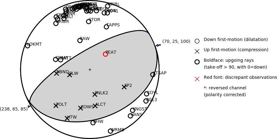
Number of P First motions: 50
| Plane A | Plane B | Uncertainty | |
|---|---|---|---|
| Strike | 70 | 238 | 28 |
| Dip | 25 | 65 | 10 |
| Rake | 100 | 85 | 40 |
Discrepant Stations
Stations whose observed first-motion does not match the predicted first-motion from the focal mechanism.| Station | Network | Channel | Polarity | Quality |
|---|---|---|---|---|
| PEAT | UW | HNZ | D | 0.9243 |
Solution 2
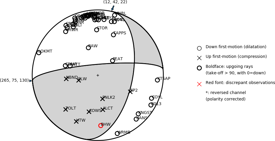
Number of P First motions: 50
| Plane A | Plane B | Uncertainty | |
|---|---|---|---|
| Strike | 265 | 12 | 25 |
| Dip | 75 | 42 | 18 |
| Rake | 130 | 22 | 30 |
Discrepant Stations
Stations whose observed first-motion does not match the predicted first-motion from the focal mechanism.| Station | Network | Channel | Polarity | Quality |
|---|---|---|---|---|
| BHW | UW | HHZ | D | 0.9771 |