The Hills are Alive with the Sound of … Earthquakes?
Background: The Challenges of Predicting Seismic Hazard
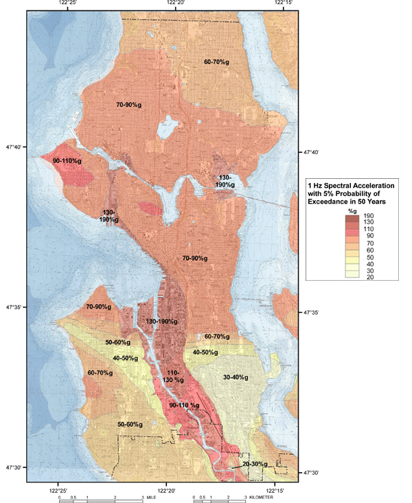
We all want to know when the next big earthquake will happen. But because we can’t predict earthquakes, the next best thing we can do is figure out how strong shaking could be during future quakes. To do this, earth scientists can reconstruct an area’s historic earthquake record using geologic markers and any available written accounts, which allows them to constrain recurrence and magnitude ranges for quakes on local faults. Scientists then combine these estimates with what we know about an area’s surface geology to predict how often and how strong the ground will shake during an earthquake. This sort of analysis is the basis for the US’ National Seismic Hazard Mapping Project, and it is critical for making sure we build structures that can withstand earthquake shaking.
Predicting how an earthquake will shake an area is not a trivial task, however. Besides the challenges of figuring out the historical earthquake record from sparse geologic markers, understanding how conditions at a given location will affect earthquake shaking is very difficult. In Seattle, for example, there are many interesting geologic features that change and amplify ground motion during earthquakes; large areas of water-logged, artificial fill under Pioneer Square and SODO have amplified ground motion and even liquefied during historic earthquakes; the deep Seattle Basin, which contains thick layers of relatively soft sediments, traps seismic waves and “sloshes” like a big bowl of jelly in some earthquakes. Taking these effects into consideration during seismic hazard analysis is important, but requires a detailed understanding of the local geology and how it affects seismic waves.
The hills are alive with the sound of … earthquakes?
A geographic component that is not often considered during seismic hazard analysis is topography. As seismic waves from an earthquake propagate through the earth, they interact with subsurface geology, like faults and basins; however, the waves also interact with surface features, like hills, cliffs, and valleys. Depending on the wavelength of the seismic waves and the direction they’re traveling, the shaking felt on these features can be much stronger (or weaker!) than in surrounding flat areas. This amplification happens because these features scatter and trap seismic energy; they can also experience a sort of structural “resonance”, similar to the way buildings and bridges can. Studies of ground motion from the 2009 L’Aquila and 2010 Haiti earthquakes [1, 2] have shown that topography significantly amplified ground motion at certain locations, sometimes shaking twice as strong as surrounding areas!
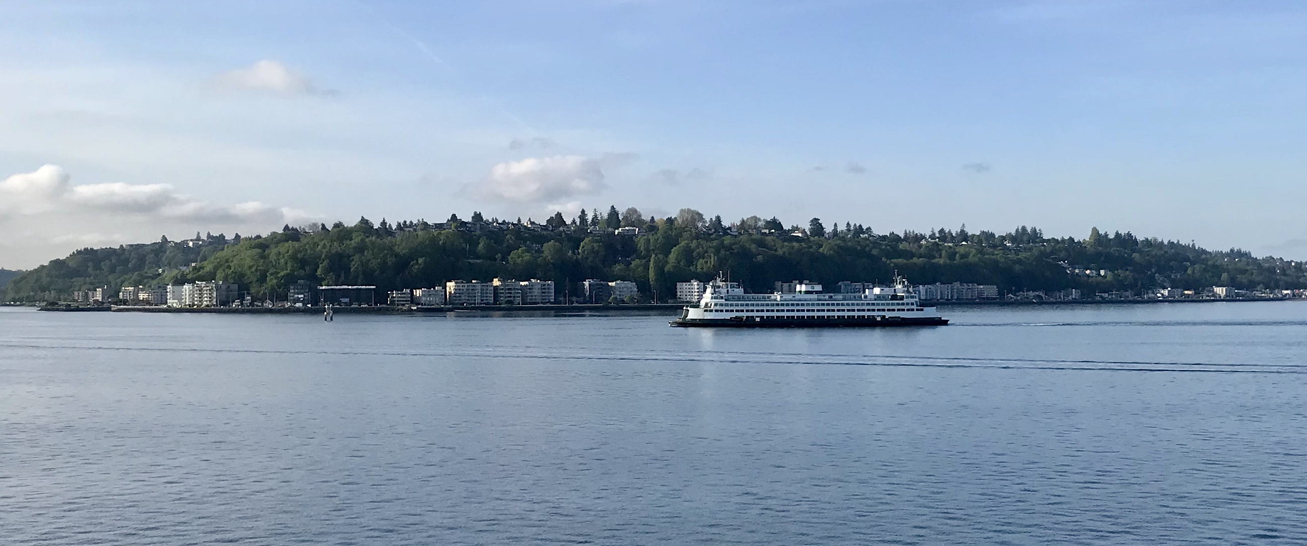
With these findings in mind, we are interested in seeing how topography might affect earthquake shaking here in Seattle. While the city doesn’t have any particularly tall or prominent ridges, it does have many steep bluffs and cliffs overlooking Elliott Bay and Puget Sound. We know from past earthquakes that these features are prone to land-sliding, and we would like to know how topographic amplification might contribute to that hazard, as well as to the general safety of structures built on the bluffs.
How will the 70-90m tall bluffs around the city behave in an earthquake?
How will things shake out in West Seattle?
So, as part of a graduate-student-led research project, we are looking for volunteers in West Seattle to host seismometers for a small experiment. In this project, portable seismometers will be placed along and down the bluffs facing Puget Sound. Over the course of a few hours, these seismometers will record the ambient vibrations caused by ocean waves, weather systems, and even car traffic. Together, these sources create what’s known as ambient seismic noise. By comparing recordings of this noise from points along the bluff, we can understand how the topography amplifies ground shaking during earthquakes.
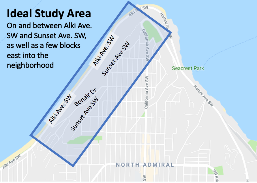
For our experiment, we are looking for hosts in West Seattle living near the bluffs along Alki. Ideally, hosts would live on or between Sunset Ave. SW and Alki Ave. SW. We also need a few sites in the neighborhood away from the sea bluff (see the map below). The experiment itself will last just 1 day, and only requires access to your yard, where we will plop-down a coffee-can sized seismometer for a few hours. The experiment will take place some time between early October and late November.
So, if you are a citizen scientist who would like to help us better understand how earthquakes rattle the hills around our city, and you live on or near the Sound-facing bluffs in West Seattle, please consider filling out the form linked below!
If you have any questions about the experiment, you can contact the project lead Ian Stone at ipstone@uw.edu
Link to Sign-up Form: https://forms.gle/vfSBgpZUapbKs5eo7
References
[1] Massa, M., Lovati, S., D’Alema, E., Ferretti, G., and M. Bakavoli, 2010. An experimental approach for estimating seismic amplification effects at the top of a ridge, and the implication for ground-motion predictions: The case of Narni, Central Italy. Bul. Seis. Soc. Amer., 100 (6) 3020-3034.
[2] Hough, S. E., Altidor, J. R., Anglade, D., Given, D., Janvier, M. G., Maharrey, J. Z., Meremonte, M., Mildor, B. S. L., Prepetit, C., and A. Yong, 2010. Localized damage caused by topographic amplification during the 2010 M 7.0 Haiti earthquake. Nature Geoscience, 3. 778-782.