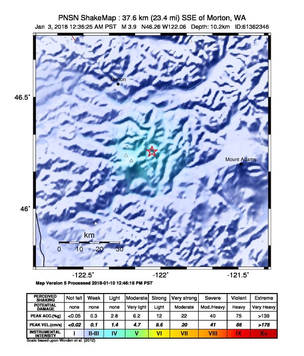
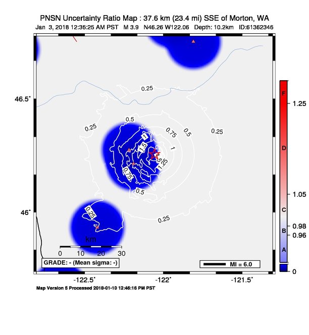
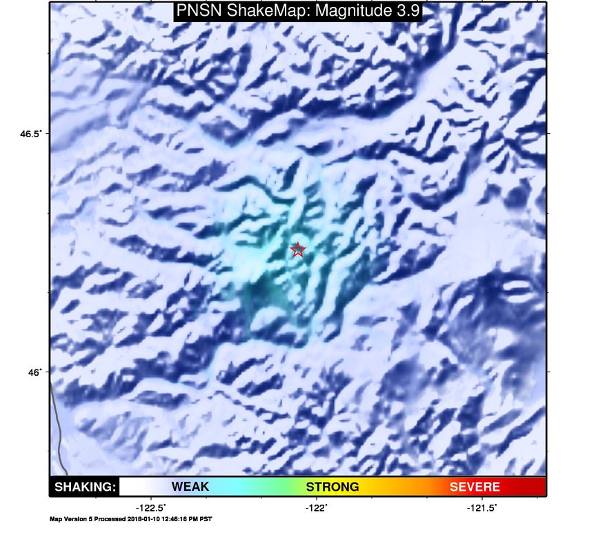
ShakeMap
Time:
Wed January 3, 2018 08:36:25 (UTC)
|
Depth:
10.27 km
|
Event ID:
61362346
|
Location:
46.256, -122.057


Downloads
| Regional | |
|---|---|
| intensity | JPG | PS.ZIP |
| acceleration | JPG | PS.ZIP |
| velocity | JPG | PS.ZIP |
| spectral 0.3 | JPG | PS.ZIP |
| spectral 1.0 | JPG | PS.ZIP |
| spectral 3.0 | JPG | PS.ZIP |
| uncertainty | JPG | PS.ZIP |
| tv map | JPG | PS.ZIP |
| tv map bare | JPG | PS.ZIP |
| tv info sheet | TXT |
| grid | XYZ.ZIP | XML.ZIP |
| gis | ZIP |
| station | TXT | XML |
| metadata | TXT |
Earthquake
| Event ID | Magnitude | Date | Time | Lat | Lon | Depth |
| 61362346 | 3.9 | // | :: | N46.25570 | W122.05630 | 10.23 km |
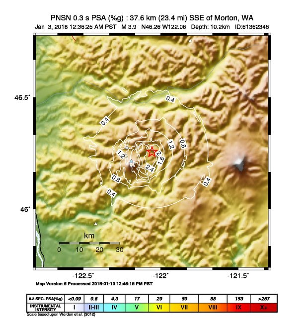
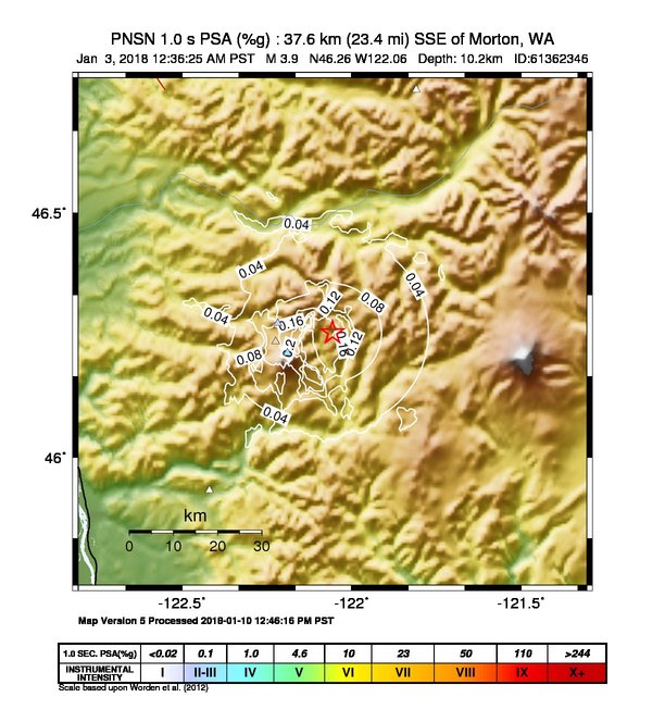
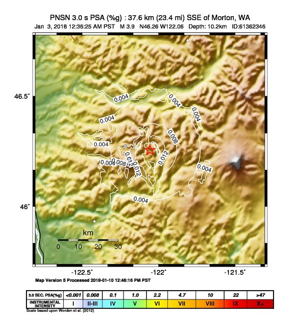
| Magnitude Bias: | MMI | PGA | PGV | PSA 0.3 | PSA 1.0 | PSA 3.0 |
| -0.85 | 0.27 | 0.13 | 0.28 | 0.10 | 0.06 |
Seismic Stations
| CC.JRO: | Johnston Ridge Observatory | Agency: Cascade Chain Volcano Monitoring | |||
| Lat: 46.27510 Lon: -122.21780 Distance: 16.23 km from source | |||||
| Intensity: 3.1 | |||||
| Station Comp | Max Vel (cm/s) | Max Acc (%g) | PSA: 0.3 sec (%g) | 1.0 sec (%g) | 3.0 sec (%g) |
| --.BHE | 0.1212 | 0.6562 | 0.3755 | 0.0444 | 0.0024 |
| --.BHN | 0.2478 | 0.8925 | 0.6795 | 0.0723 | 0.0053 |
| CC.STD: | Studebaker Ridge, Mount St Helens, WA | Agency: Cascade Chain Volcano Monitoring | |||
| Lat: 46.23749 Lon: -122.22421 Distance: 16.60 km from source | |||||
| Intensity: NaN | |||||
| Station Comp | Max Vel (cm/s) | Max Acc (%g) | PSA: 0.3 sec (%g) | 1.0 sec (%g) | 3.0 sec (%g) |
| --.BHE | 0.4379 | 1.9148 | 1.4073 | 0.0594 | 0.0057 |
| --.BHN | 1.3787 -G | 4.8255 -G | 3.2563 -G | 0.1784 -G | 0.0189 -G |
| CC.VALT: | Mt. St. Helens Crater, WA | Agency: Cascade Volcano Obervatory | |||
| Lat: 46.21422 Lon: -122.18925 Distance: 15.18 km from source | |||||
| Intensity: 3.2 | |||||
| Station Comp | Max Vel (cm/s) | Max Acc (%g) | PSA: 0.3 sec (%g) | 1.0 sec (%g) | 3.0 sec (%g) |
| --.BHE | 0.3121 | 1.1205 | 1.4579 | 0.2365 | 0.0128 |
| --.BHN | 0.3165 | 1.2136 | 2.9830 | 0.1730 | 0.0125 |
| UW.LON: | Longmire CREST broad-band | Agency: Pacific Northwest Regional Seismic Network | |||
| Lat: 46.75060 Lon: -121.80960 Distance: 59.07 km from source | |||||
| Intensity: 1.0 | |||||
| Station Comp | Max Vel (cm/s) | Max Acc (%g) | PSA: 0.3 sec (%g) | 1.0 sec (%g) | 3.0 sec (%g) |
| --.BHE | 0.0144 | 0.0476 | 0.0613 | 0.0097 | 0.0006 |
| --.BHN | 0.0124 | 0.0730 | 0.0412 | 0.0036 | 0.0003 |
| UW.YACT: | Amboy, WA, USA | Agency: Pacific Northwest Regional Seismic Network | |||
| Lat: 45.93250 Lon: -122.41930 Distance: 46.69 km from source | |||||
| Intensity: 1.9 | |||||
| Station Comp | Max Vel (cm/s) | Max Acc (%g) | PSA: 0.3 sec (%g) | 1.0 sec (%g) | 3.0 sec (%g) |
| --.HHE | 0.0444 | 0.2791 | 0.1529 | 0.0073 | 0.0008 |
| --.HHN | 0.0352 | 0.1820 | 0.0812 | 0.0094 | 0.0008 |