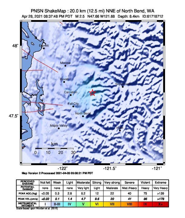
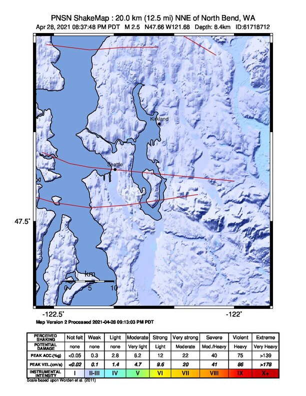
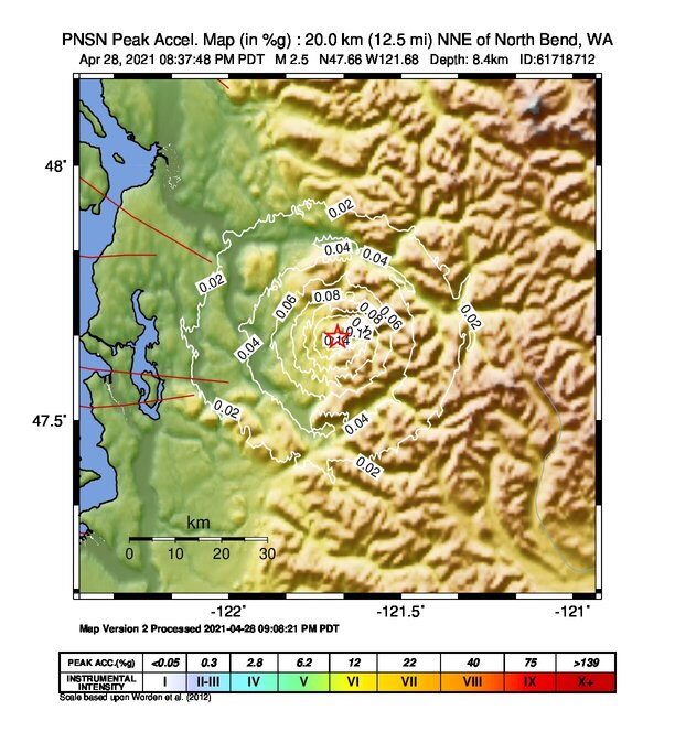
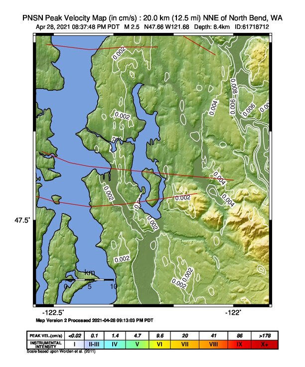
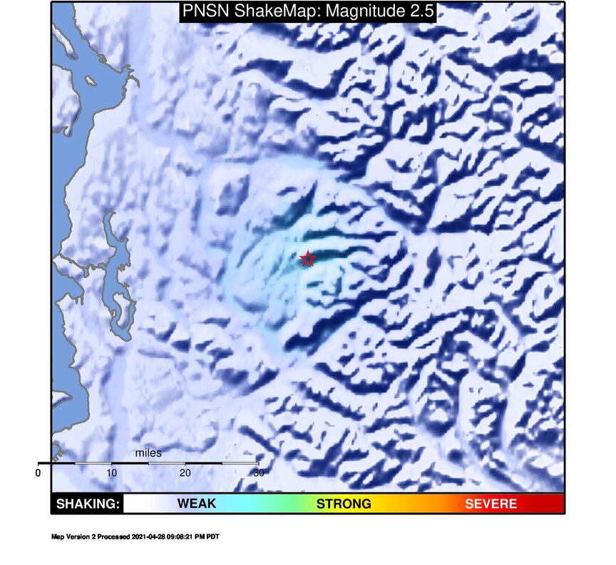
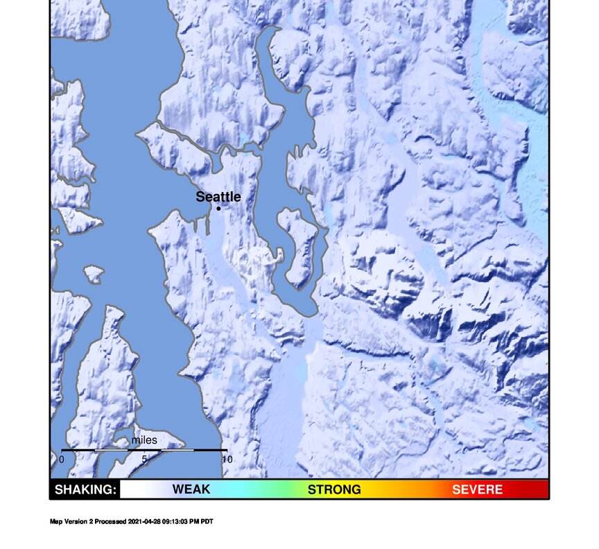
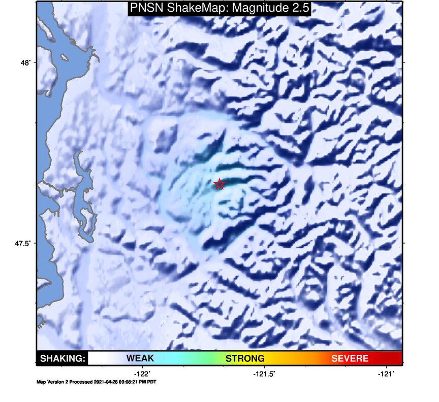
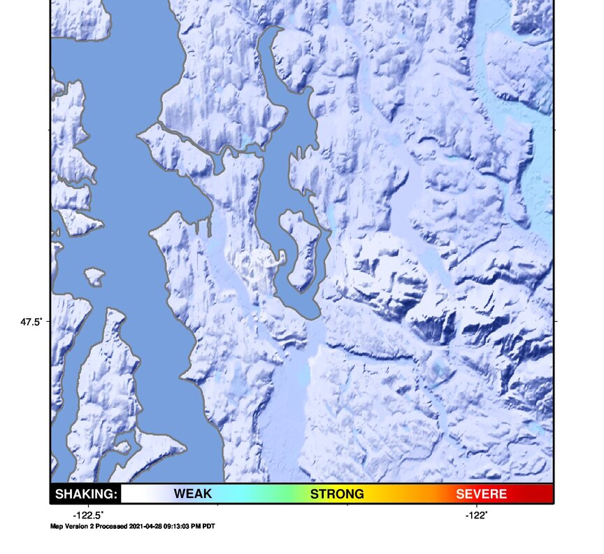
ShakeMap
Time:
Thu April 29, 2021 03:37:47 (UTC)
|
Depth:
8.37 km
|
Event ID:
61718712
|
Location:
47.664, -121.684


Downloads
| Regional | High Resolution Seattle | |
|---|---|---|
| intensity | JPG | PS.ZIP | JPG | PS.ZIP |
| acceleration | JPG | PS.ZIP | JPG | PS.ZIP |
| velocity | JPG | PS.ZIP | JPG | PS.ZIP |
| spectral 0.3 | JPG | PS.ZIP | JPG | PS.ZIP |
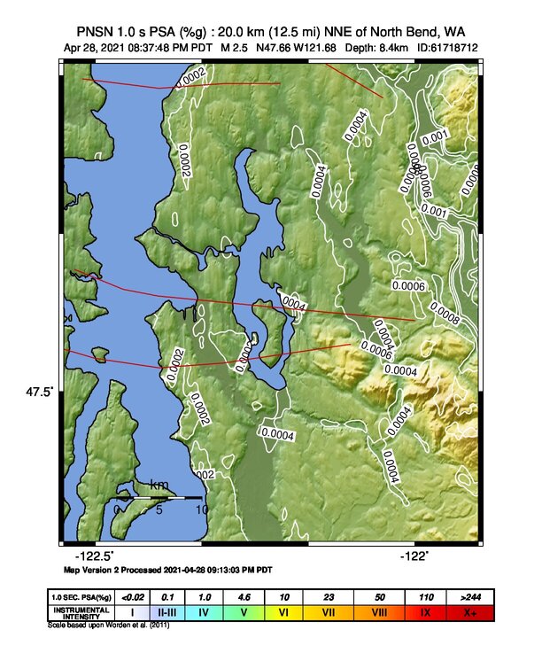
| spectral 1.0 | JPG | PS.ZIP | JPG | PS.ZIP |
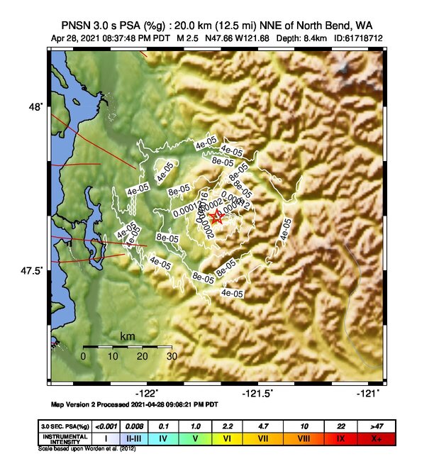
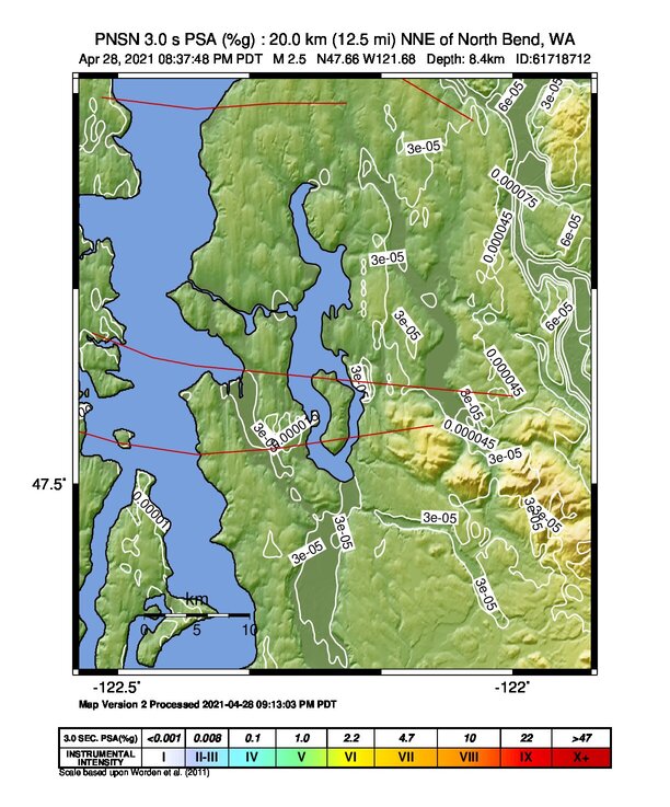
| spectral 3.0 | JPG | PS.ZIP | JPG | PS.ZIP |
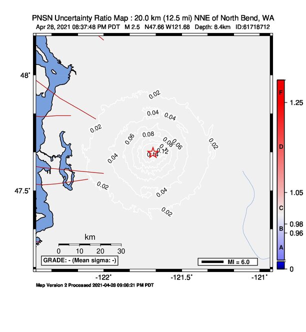
| uncertainty | JPG | PS.ZIP | JPG | PS.ZIP |
| tv map | JPG | PS.ZIP | JPG | PS.ZIP |
| tv map bare | JPG | PS.ZIP | JPG | PS.ZIP |
| tv info sheet | TXT | TXT |
| grid | XYZ.ZIP | XML.ZIP | XYZ.ZIP | XML.ZIP |
| gis | ZIP | ZIP |
| station | TXT | XML | TXT | XML |
| metadata | TXT | TXT |
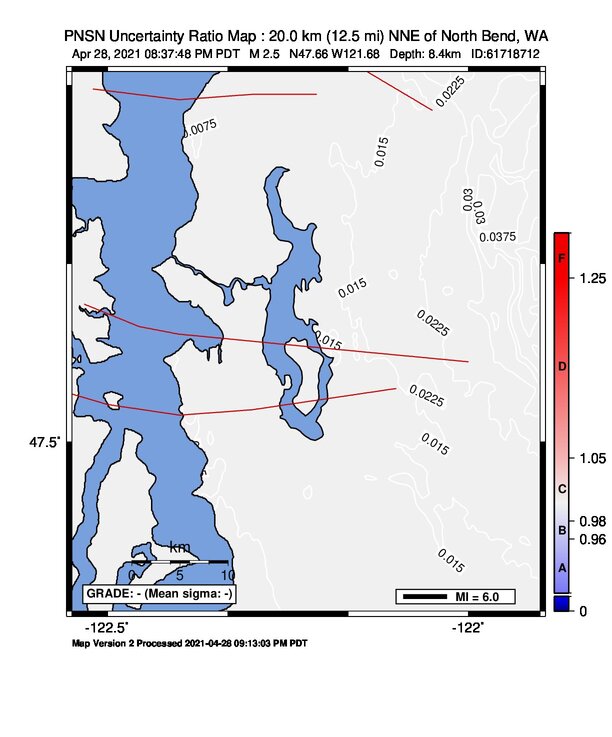
Earthquake
| Event ID | Magnitude | Date | Time | Lat | Lon | Depth |
| 61718712 | 2.5 | // | :: | N47.66350 | W121.68420 | 8.37 km |
| Magnitude Bias: | MMI | PGA | PGV | PSA 0.3 | PSA 1.0 | PSA 3.0 |
| 0.00 | 0.00 | 0.00 | 0.00 | 0.00 | 0.00 |
Seismic Stations
Earthquake
| Event ID | Magnitude | Date | Time | Lat | Lon | Depth |
| 61718712 | 3.0 | // | :: | N47.66350 | W121.71180 | 5.71 km |
| Magnitude Bias: | MMI | PGA | PGV | PSA 0.3 | PSA 1.0 | PSA 3.0 |
| 0.00 | 0.00 | 0.00 | 0.00 | 0.00 | 0.00 |